Cities Skylines Traffic Guide
Cities Skylines Traffic Guide by drushkey
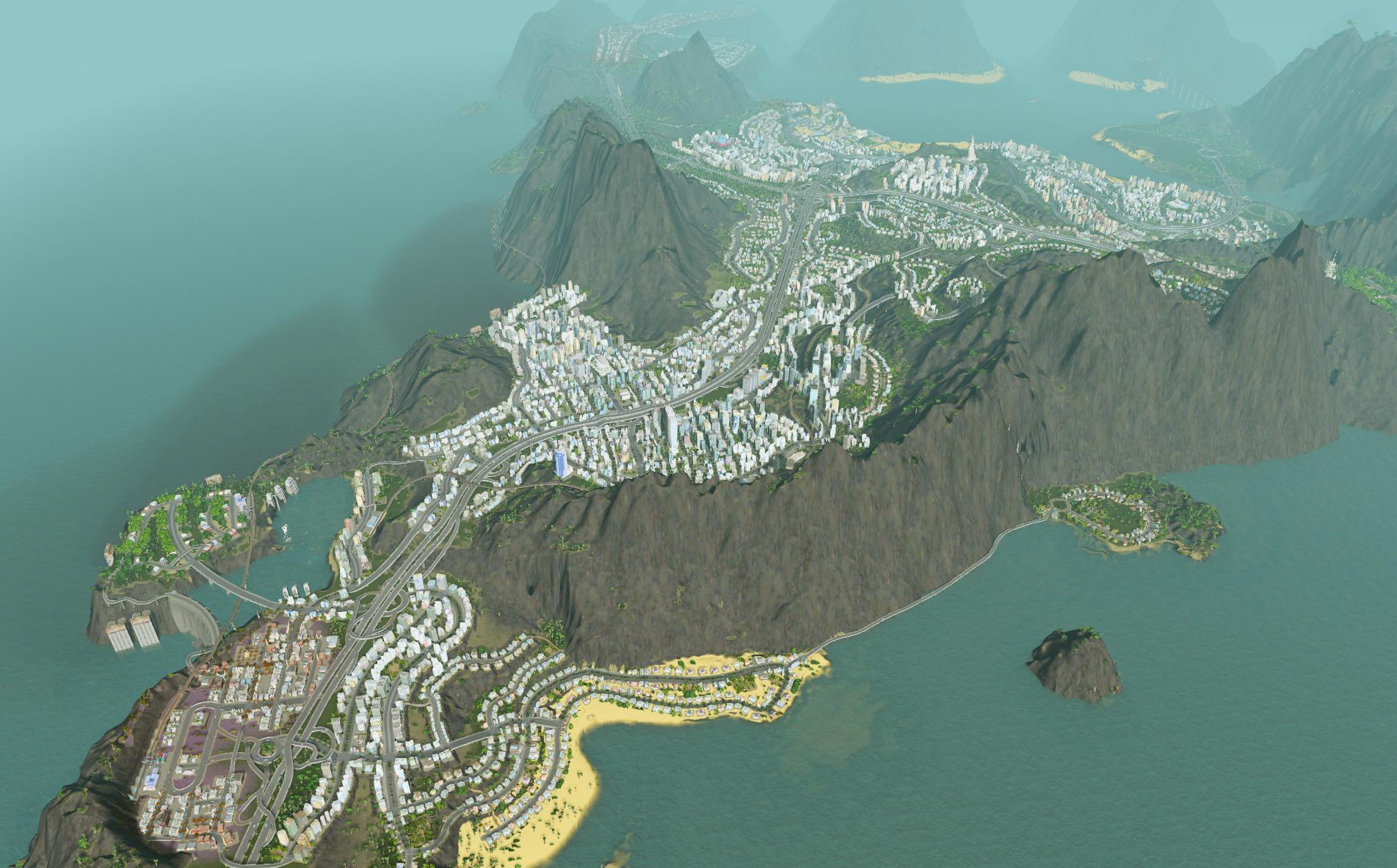
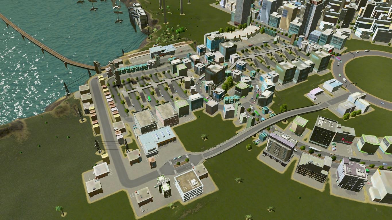
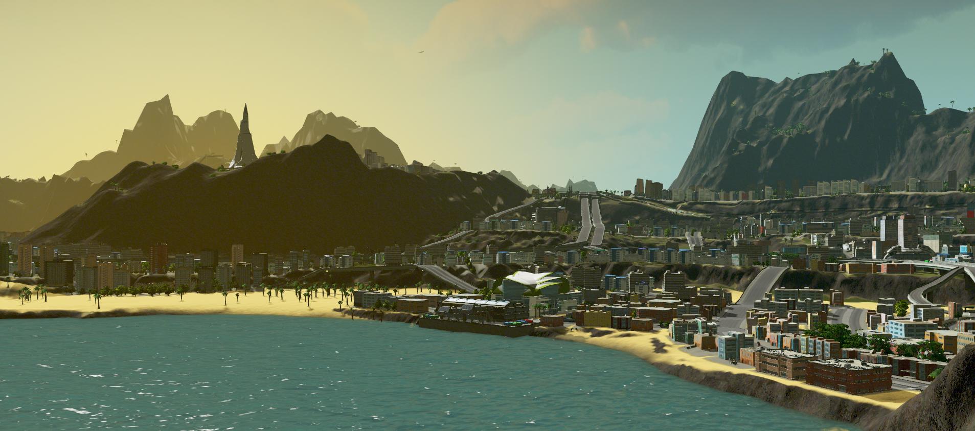
So this is my current baby, Victoria. 75 000 cims and growing. Not the biggest or most beautiful city by any means, but it has a delicious secret:
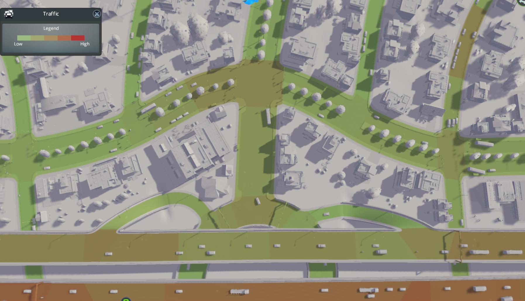
No traffic problems! Of course, the traffic overlay has some red spots, but…
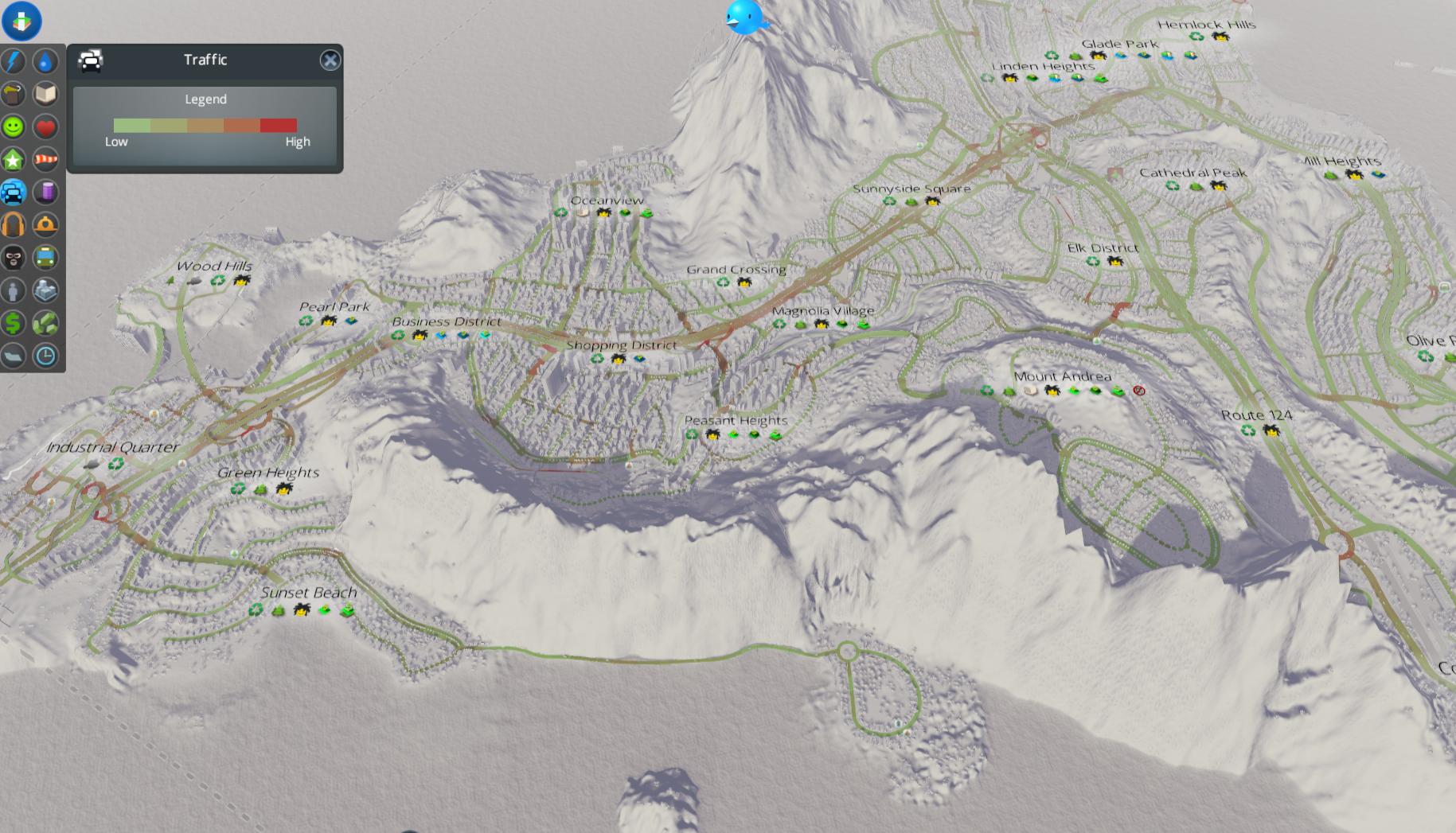
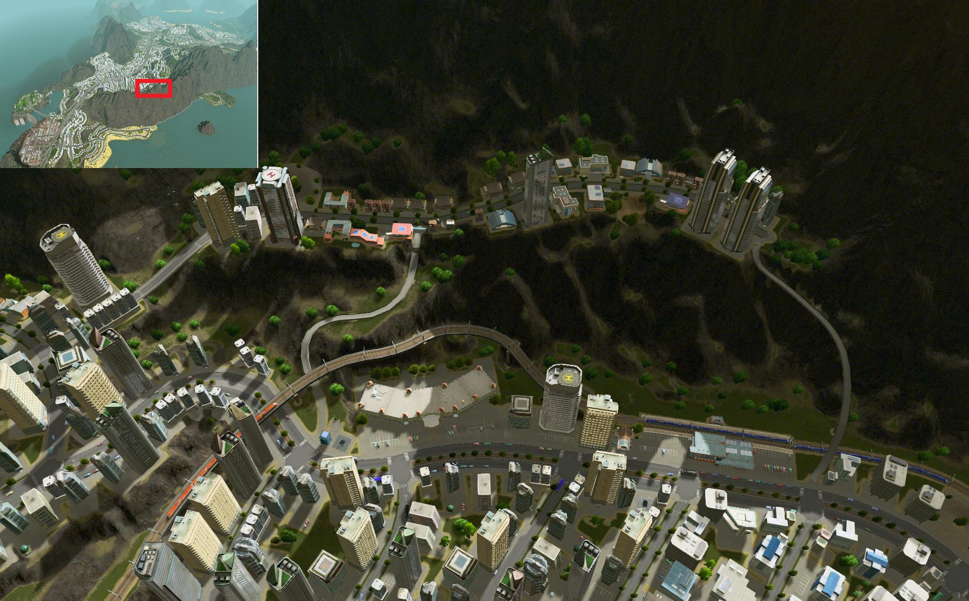
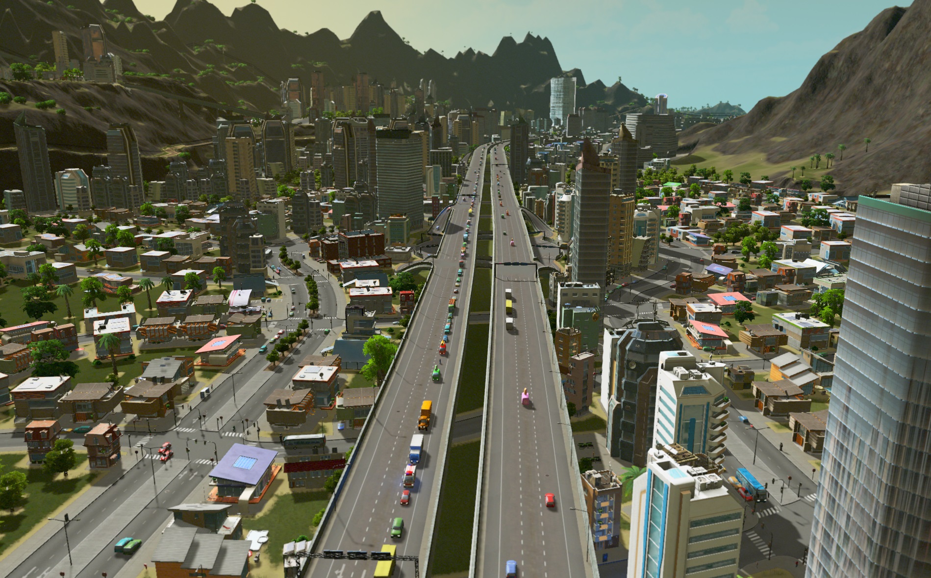
No actual congestion, just the game telling me there’s high traffic volume, which I assume it uses to determine it’s a pretty noisy place to live. This is the first exit to the only highway access to the city.
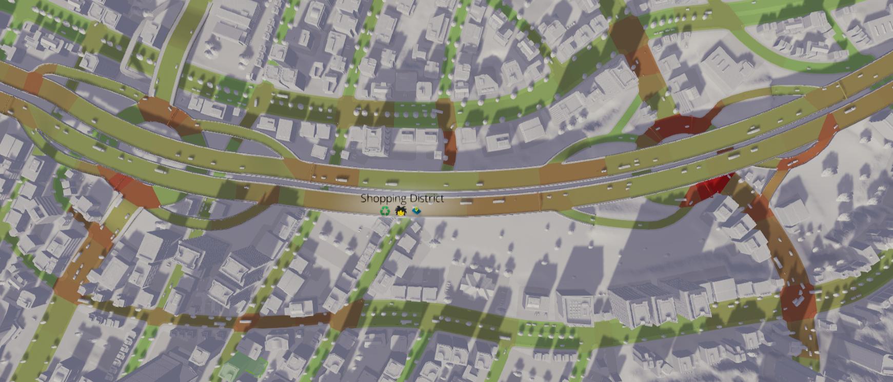
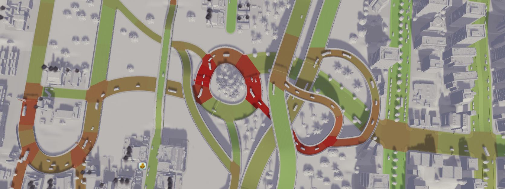
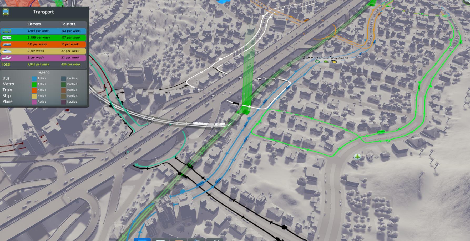
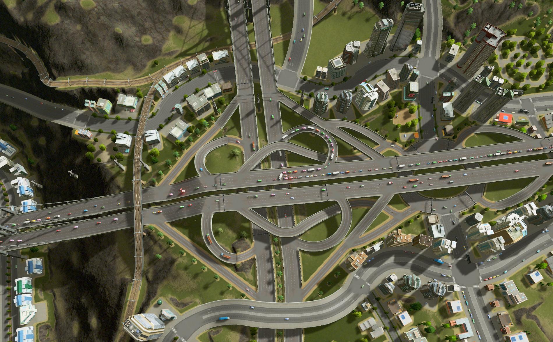
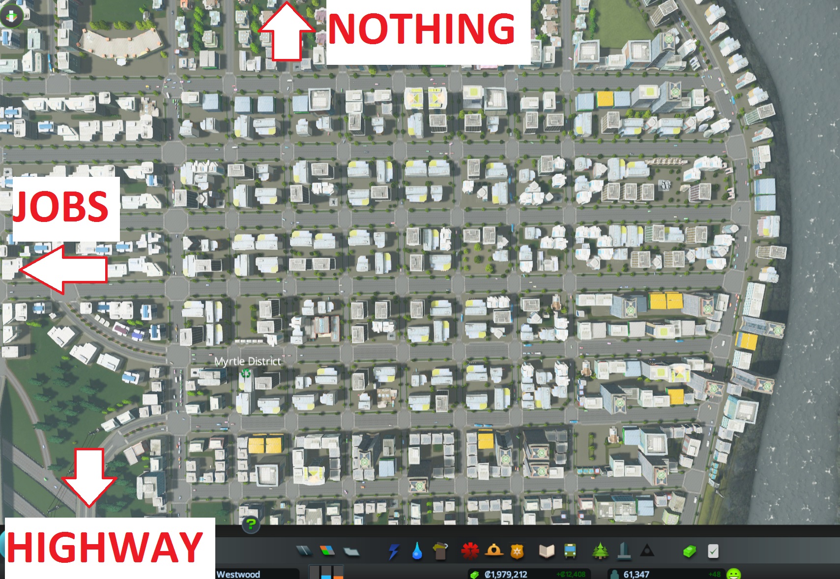
And this is downtown, in the middle of the action. These two exits together are the main highway access for nearly 30 000 cims, and almost certainly as many jobs – not to mention Victoria U. TL;DR : no congestion, quick commutes, and (most importantly) excellent access to city services. Remember that first picture of my city? Not a single garbage dump or incinerator is in view.
“Good for you, but how do I do that?”

The basic, textbook idea is simply three hierarchical levels of the network: local (2-lane roads), connecting (4- and 6-lanes) and regional (highways) (there’s really a fourth level, national, which in-game would be the outside connection, but we don’t build those so forget them). This organization is how pretty much all cities are built IRL.
Local roads should be where most people live; they’re basically an extension to your driveway, letting you get to the real road network. They don’t bring you anywhere themselves, other than maybe the corner store.
Connecting roads get you around the neighborhood. They’re wider, faster, and people travelling on them get higher priority at intersections than those on local roads. That said, you can still live or work on them.
Regional roads are even faster: no intersections, no driveways, high speed limit. Highways obviously fit this, but any kind of road can fit this description if built the right way, e.g. feeding the outskirts of your city with a 6-lane road with intersections hundreds of meters apart.

Here’s an example: all high-density with the only escapes the highway to the right and that one slightly orange 6-laner to the “north” and “south”. As you can see, connecting roads don’t have to be single straight lines to the regional ones, so long as their intersections are relatively far apart.
Public transit is the same idea: long, fast stretches for regional (e.g. trains and subways), buses within the neighborhood, and your cims’ own two feet to get to the door.
“But why not just make ALL the roads 4 or 6 lanes, if they’re faster and have higher volume?”
Good question, hypothetical reader! IRL the answer is style and money, the latter of which applies in-game too. More importantly though, your cims select their routes based on time-to-destination, assuming no traffic (I don’t know this for a fact, but I’m pretty confident it’s mostly true). This means they’ll tend to funnel towards the larger roads, if given the choice.
That in turn means that, as planned, the only traffic on local roads is going to be those cims who have to use them. Even with relatively long stretches of high-density development, that’s only a few sims an RL minute at the fastest speed, versus many, many more on the bigger routes.
(The following is based on 15 minutes of me watching intersections with a stopwatch).
Conveniently, intersection signals in Cities: Skylines seem to be based on detectors: they’ll stay green for the last direction to have traffic, until either ~5 seconds elapse or vehicles arrive in a conflicting lane, whichever comes first. If both roads have similar loads, that’s 50% green time for each, cutting the capacity of both in half. In the case pictured, however, over 5 minutes the 4 lane avenue got 32 seconds of green for every 5 on the local road.

I *think* you can improve that a touch more by having the local roads be alternating one-way streets. IRL, having no traffic coming in the opposite direction is a serious boost to capacity. Cims being robots, though, can drive between each other without a care in the world, and my local streets don’t have enough traffic on them either way for a serious comparison. There’s also the issue that you need more intersections, since the services may have to travel around the block, slowing them down. Still, I like them.
Trucks! Trucks everywhere!
Of course, all of the above applies mostly to cars and commuters, who can go from anywhere to anywhere. You have to provide them with very general solutions, but you can let them do there thing once they’re almost home.

Industry is different. If you’re like me, you have it concentrated in a few areas, and while there are less trucks than cars on the roads they almost ALL take the same few routes. These routes will suffer huge volumes, potentially domino-ing to your city’s untimely demise.
Fortunately, the game provides a few very powerful solutions, unique to industry:
1) District policies
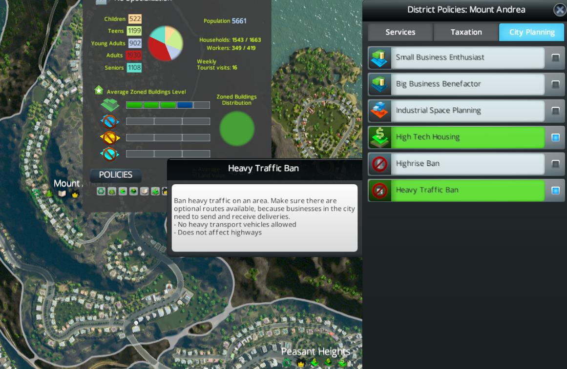
Banning heavy traffic is free, and thanks to your amazing police force 100% effective: no trucks will go through the district. Obviously, this only moves the problem, but it can push trucks out of quiet little Suburbiton and onto the specially built highway, despite it being a 6 hour detour.
Just don’t forget that cargo has to go SOMEWHERE. If you don’t provide any routes, your industries aren’t going to be happy.
2) Cargo trains
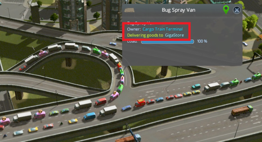
At first I thought cargo trains were only for getting goods out of or into the city. Not so! While you don’t create routes for them like you do for other transit networks, the cargo train stations will kindly figure it out themselves and bring cargo wherever it’s needed. Moreover, since cargo is far more predictable than commuters, you can quickly and cheaply build a very simple, out-of-the-way network that heavily reduces the number of trucks on the roads.
…well, on the roads that matter anyway. Cargo still has to get to and from the train stations, and no clever tricks can increase the capacity of the cargo bay itself. You can easily get long truck lines for the train station. I don’t know a real solution to this, but there’s 2 ways to reduce the problem.
First, if you’re facing the front of the station, know that trucks always enter on the right and exit on the left. Build it on a one-way road going that direction, and at least you won’t have the added problem of them yielding to each other.
Second, you can just build the train station somewhere where lines won’t bother anyone, and then hide that section when you’re showing off the low traffic in your city :/
Dem clever industries
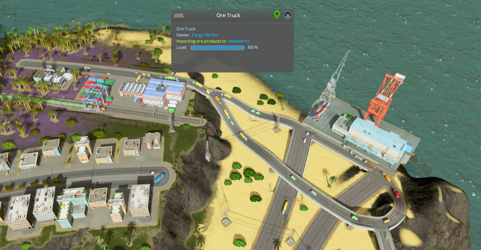
One last thing for industry which isn’t immediately obvious: cargo can take some pretty clever and complex routes. This is a train station right next to the cargo harbor; trains bring the cargo from all around the city to the station, which then spawns trucks to drive it to the ships. The harbor does the same thing for imports.
Do note that this will create some MEAN traffic between them. I gave them a dedicated set of onramps. It would be nice if the train could offload directly to the ships, but what can you do.
PUBLIC TRANSIT

So far, it’s been all about cars and trucks. You can get away with them alone if you want… though who knows why you would want to do that, because public transit is incredibly efficient:
– Every person using mass transit is one less car on the road. That’s up to 30 per bus, 240 per train.
– Thanks to the former, you end up indirectly increasing the capacity of your roads, since you can fit more people in less vehicles.
– Less cars = less noise, increasing land value (though transit stations also generate noise, so it’s not perfect).
– Transit stations count as a service, directly producing happy faces in their vicinity. If you want to max office levels, you pretty much need public transit access.
– It’s fun to follow trains around. I could do it for hours.

Real traffic engineering is never this immediately satisfying.
The basics: placing an efficient single line.

A fact true both IRL and in Skylines is that most trips are from A to B, and then back to A. Therefore, just connecting two places together isn’t enough: it should be just as easy to get back to the start. This may seem obvious to you if you’ve been using mass transit regularly, but look at this:
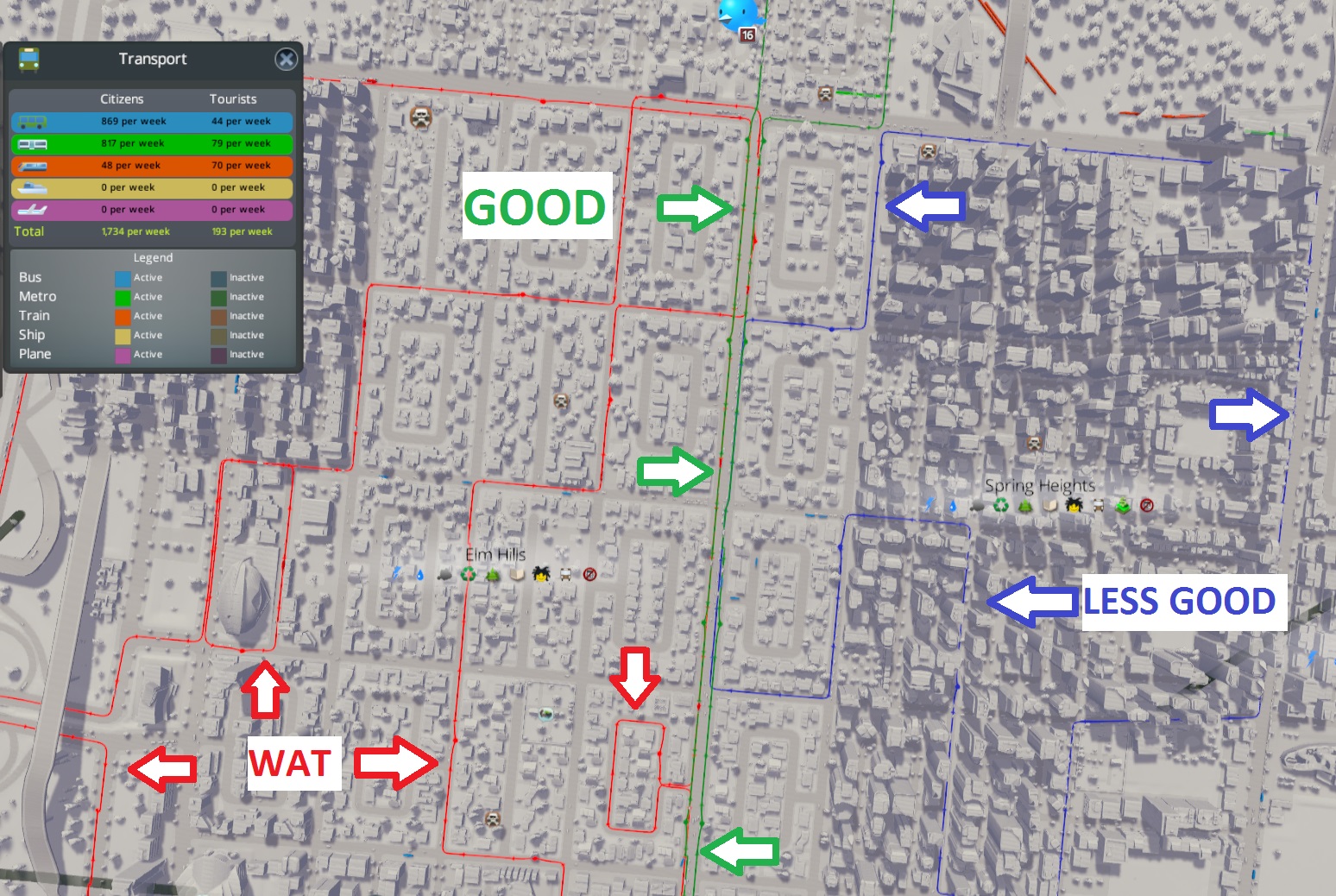
I did not make that red line.
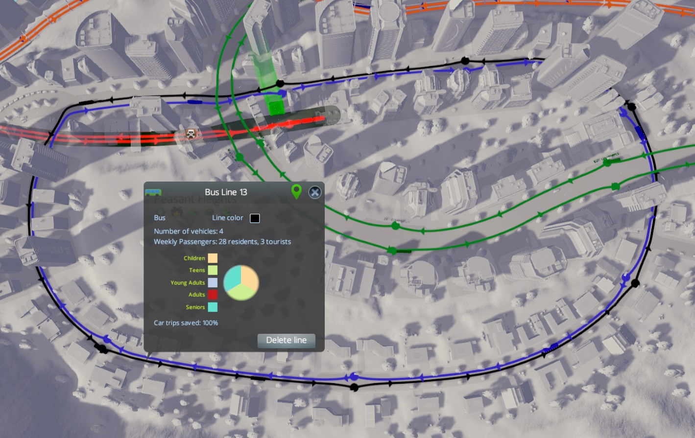
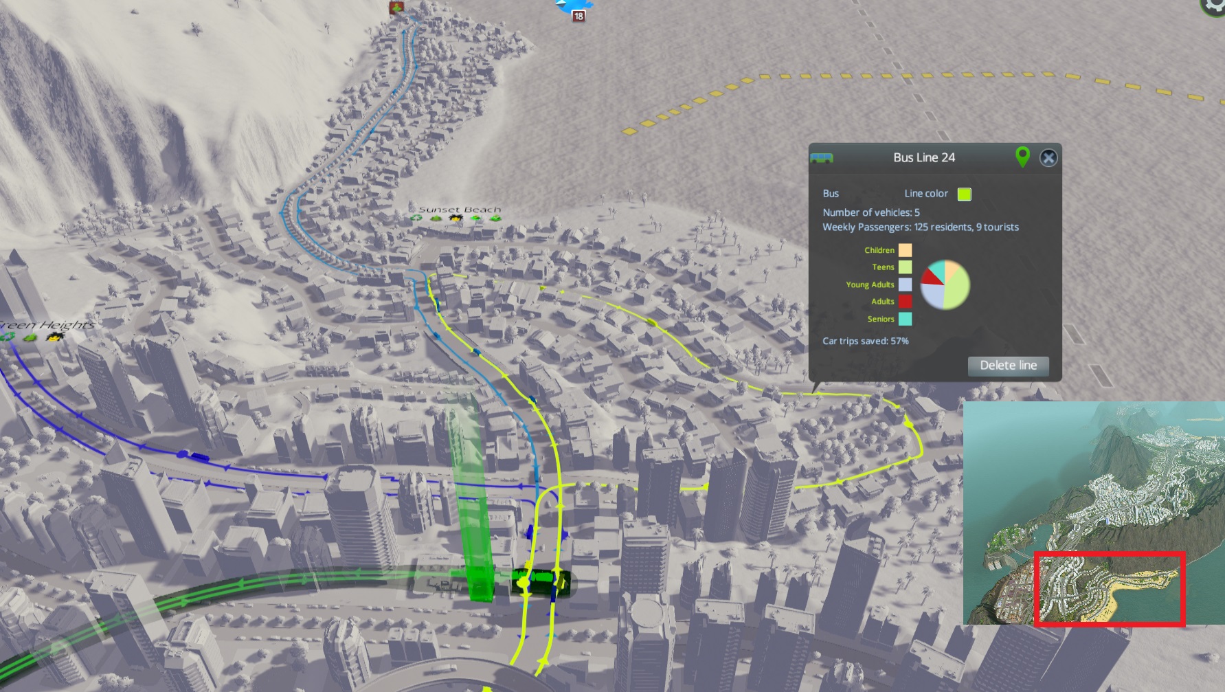
The green (good) line is as bog standard as you can get, but it’s standard for a reason: all you have to do to get back home is to take the bus across the street from where you got off. It’s also a perfectly straight line which, while not always practical, to do, means the bus is taking the shortest possible path between any two stops. As a consequence, this line has a moderately OK “trips saved” stat of 32% (which isn’t bad, considering these are the only lines in the city and took all of a minute to make).
The blue “less good” line is the kind of thing you’d do if you were just trying to maximize coverage. The problem is that it’s like travelling on the hands of a clock: getting from 12 to 3 is pretty efficient, but to get back you have to go through all the other nine hours. The cims seem to realize that, and as a result the “trips saved” are only 26%. That’s not to say this kind line is useless though, as I’ll show later.
The red line is an extreme case, but one I know for a fact people do on occasion. I could go into all the problems, but as a rule of thumb, if it’s not immediately obvious where people would use the line to go, it’s not going to be very efficient. The result is that this line saves only 12% of trips, despite having the most buses and covering the most zones.
As I said, loop lines have their uses. Here, the road was already a circle; a linear line would have been awkward. To avoid the going-around-the-clock problem, there’s an added line going the other way.
The result is amazing effectiveness, both lines giving me 100% car trips saved. That said, they also take 4 buses each, and transport a whopping 80 people/week total. Not amazingly efficient, but since the road with the green line on it feed a huge area to the right, I think it’s worthwhile in this case.

Here’s another loop, also with 100% trips saved. It’s much shorter, so not much time would be saved adding a second line. It’s also much more cost effective, with four times the passengers/bus. I wish you could manually adjust the number of buses on each line… maybe in a future patch.
Anyway, you’ll note that in both the above pictures, these loops connect to several other lines. Without these connections, there is no way they would reach 100%, since the only viable trips would be within residential zones, e.g. visiting your neighbors. Which brings us to…
Networking your transit lines
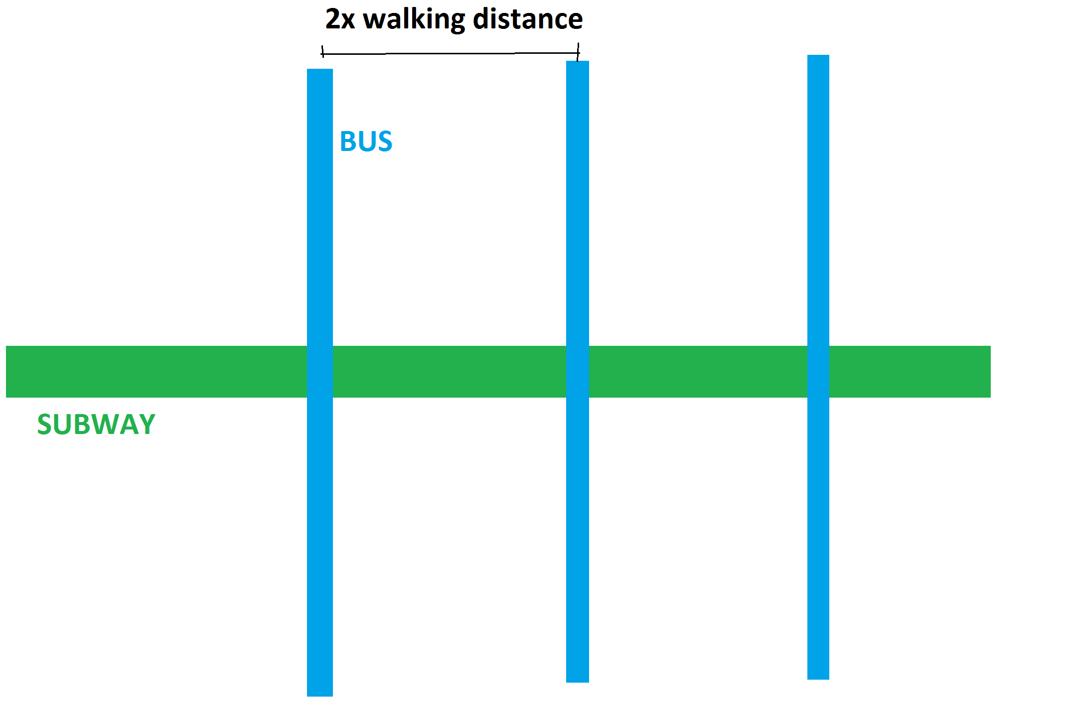
Much like with roads (and as I’ve said before) transit lines work most efficiently with a hierarchy. Typically, this has subways/trains serving the region, buses connecting within districts, and a pleasant walk along the local roads.
The above image gets the idea across, but is *extremely* idealized. The only case I can see applying that directly is if your city is super dense, a perfect grid, and shaped like an elongated rectangle.
I say dense, because subway stations that close together are not particularly efficient: trains carry a lot of passengers, but are slow to accelerate and decelerate, so minimizing stops is good (this MAY be less true in the game than IRL, but it seems similar enough to me).
And there’s one more problem: what if you want to go from the end of one of the bus lines to the one next to it? It’s a pretty big detour by mass transit.
TL;DR: If you want to network a non-hypothetical city, you have to adapt this simple idea to whatever you’ve got. Fortunately, the map I’m playing (Raerai’s Cove, by u/aKiss4Luck or Eva on Steam) – combined with my relatively improvised play-style, present a good variety of scenarios to deal with.
NOTE: The following is in descending order of the aforementioned hierarchy. While you should probably *plan* things in this order, early-on starting with bus lines is probably a more cost-effective option.
REGIONAL NETWORK
Unlike road traffic/highways which are a concern immediately, your city should already be relatively developed before you start plopping the serious transit lines. As such, you should have at least some idea of which direction you’re going to expand the different zones in, and this is the main (but not only – see below) thing to consider when planning out your regional network.
Essentially, the main non-cargo trips your city will have are residential-industrial/office and back, residential-commercial and back, and residential-industrial/office-commercial-back. The later is somewhat less common, but is important in making your commercial buildings happy – thus the “not enough customers” complaint you can get (I may be conflating real life with the game on this, but it seems to hold up).
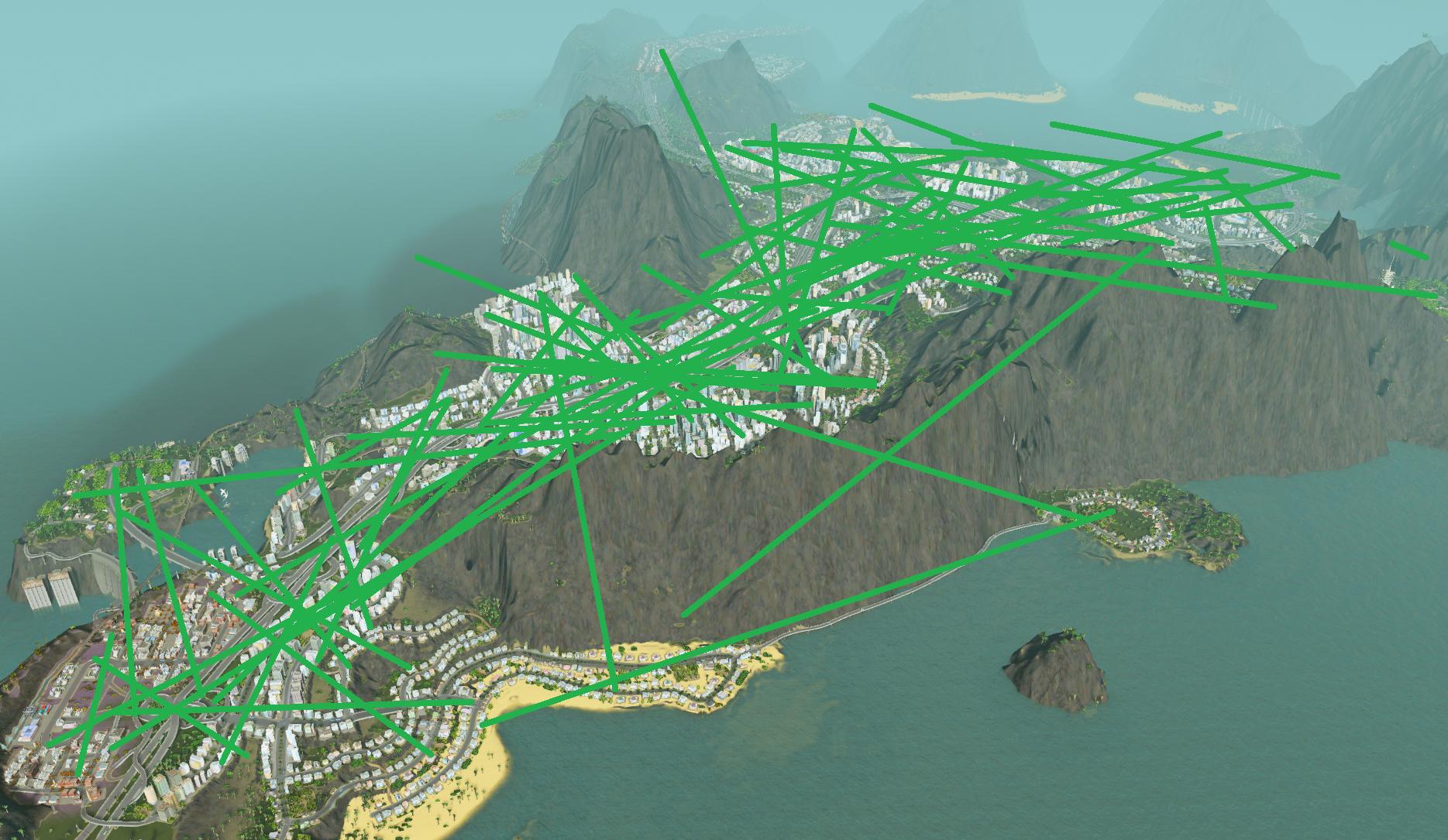
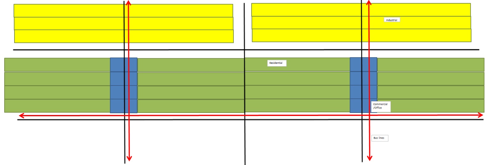
An ideal network, therefore, should gather all your users towards the commercial zones (via the horizontal red lines in the picture, generally buses) before pumping them towards the main places of work (via the vertical lines, usually either trains or subways).
It is important to keep in mind that excessive transfers will turn cims away from your transit lines, regardless of how straight and efficient they otherwise are. 2-3 transfers seems ok, but of the cims I’ve followed none seem willing to do more than that.
After your zoning, the second consideration is major trip generators: the ploppable buildings that either attract or generate a large number of people on their own. This is downplayed in-game relative to real life (for example, the entire transit system in my city readjusts whenever there’s a hockey game by adding special bus lines and additional subway trains) but is still worth worrying about, and trying to keep them on your high-capacity transit lines. The major trip generators are:
– Universities. Up to 4500 students at each means people are constantly coming and going.
– Airports/passenger harbors. With up to 100/200 passengers at a time, respectively, these don’t generate a HUGE number of trips, but make up for it by releasing them all at the same time. Remember, rush hour IRL isn’t caused by people commuting, but by them commuting in the same direction at the same time.
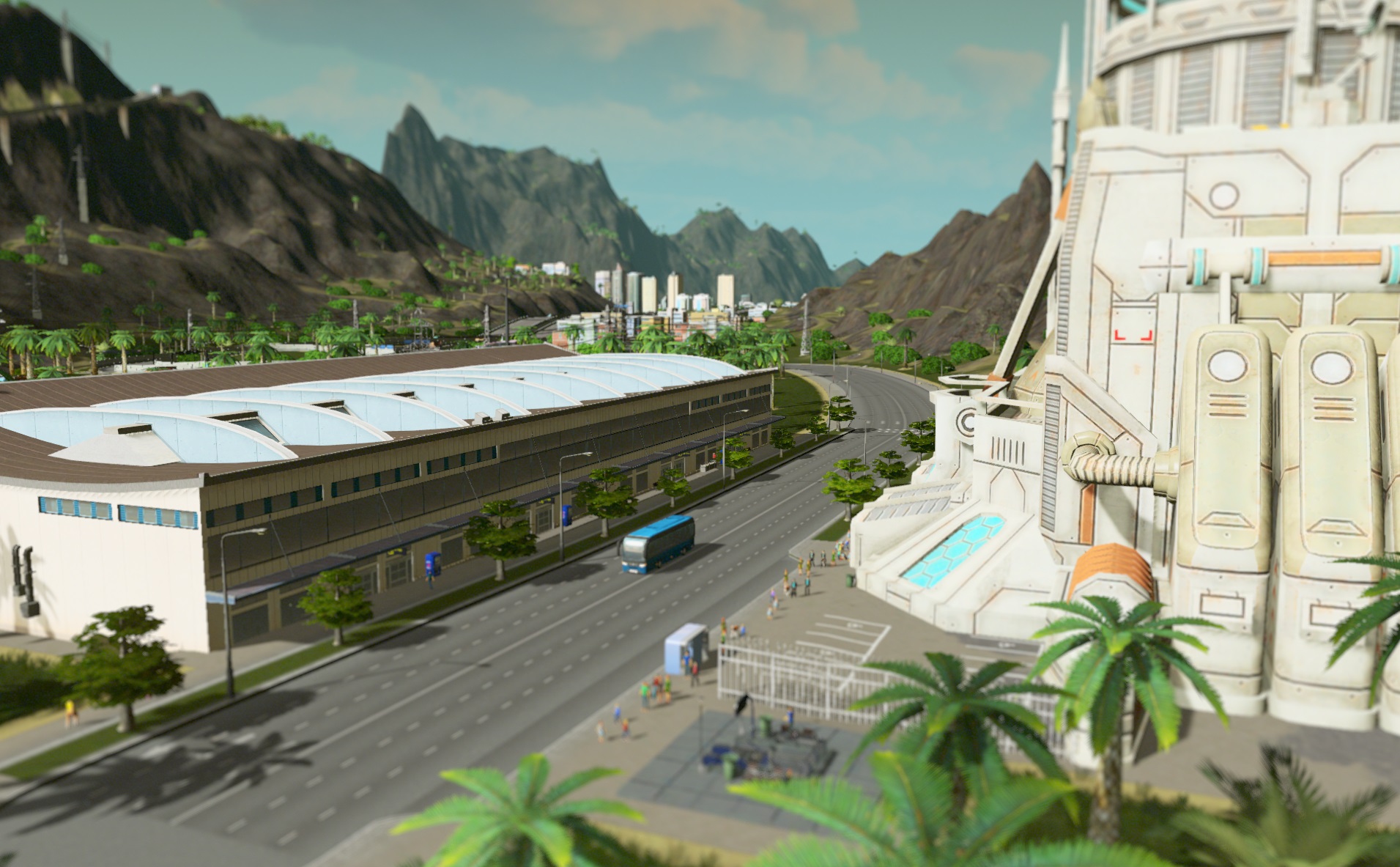
– The Space Elevator. This is the big one. People come out of it constantly, and in big numbers. If it isn’t directly adjacent to a subway or train station, you’re in trouble. (Incidentally, are the people coming out tourists from space? What’s up with that?)
Of course, high schools, elementary schools and all the unique buildings generate visitors on their own. None however are notably more than the equivalent area of high density zoning, so I don’t give them more than the same bus service I give everyone.
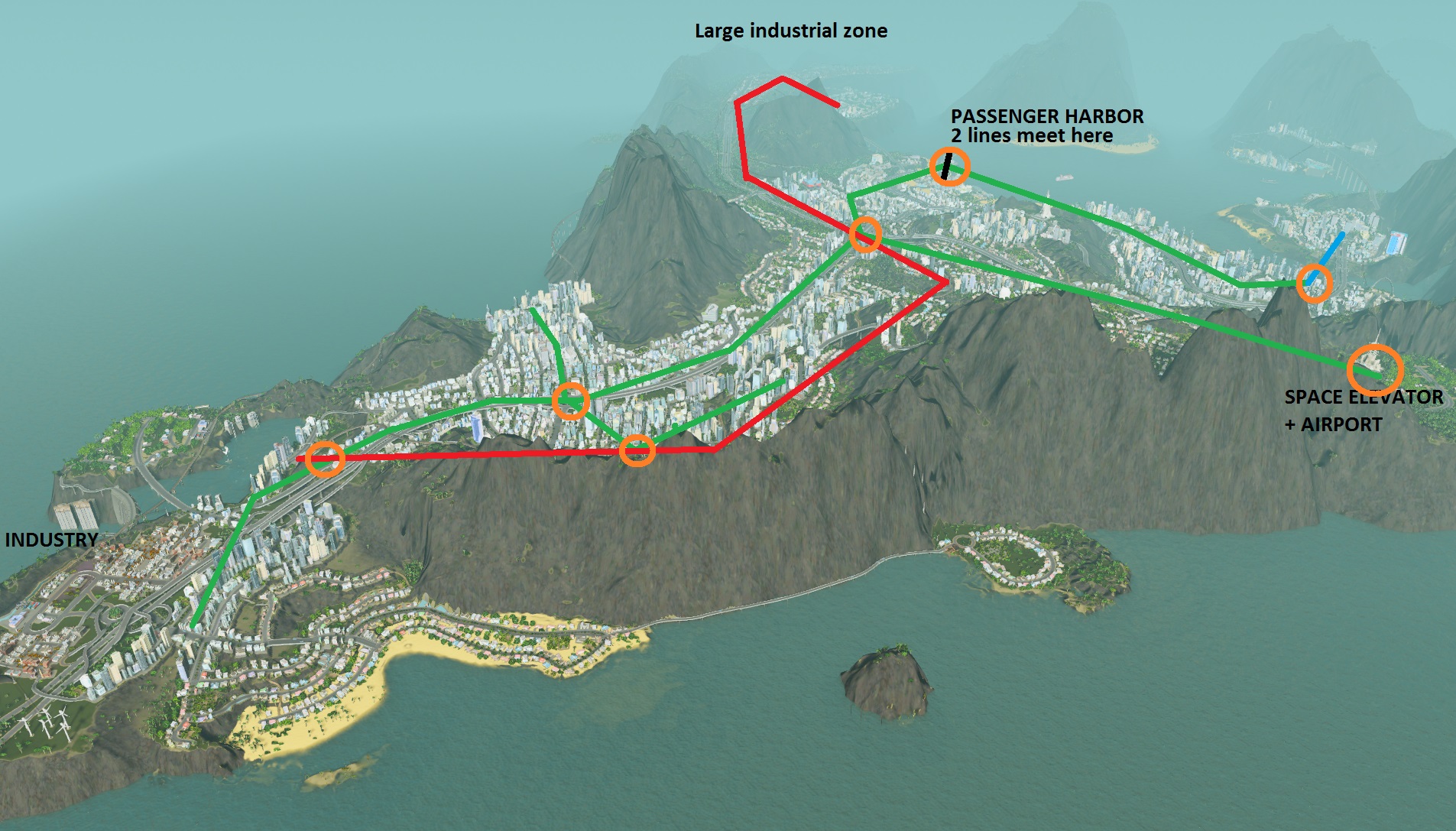
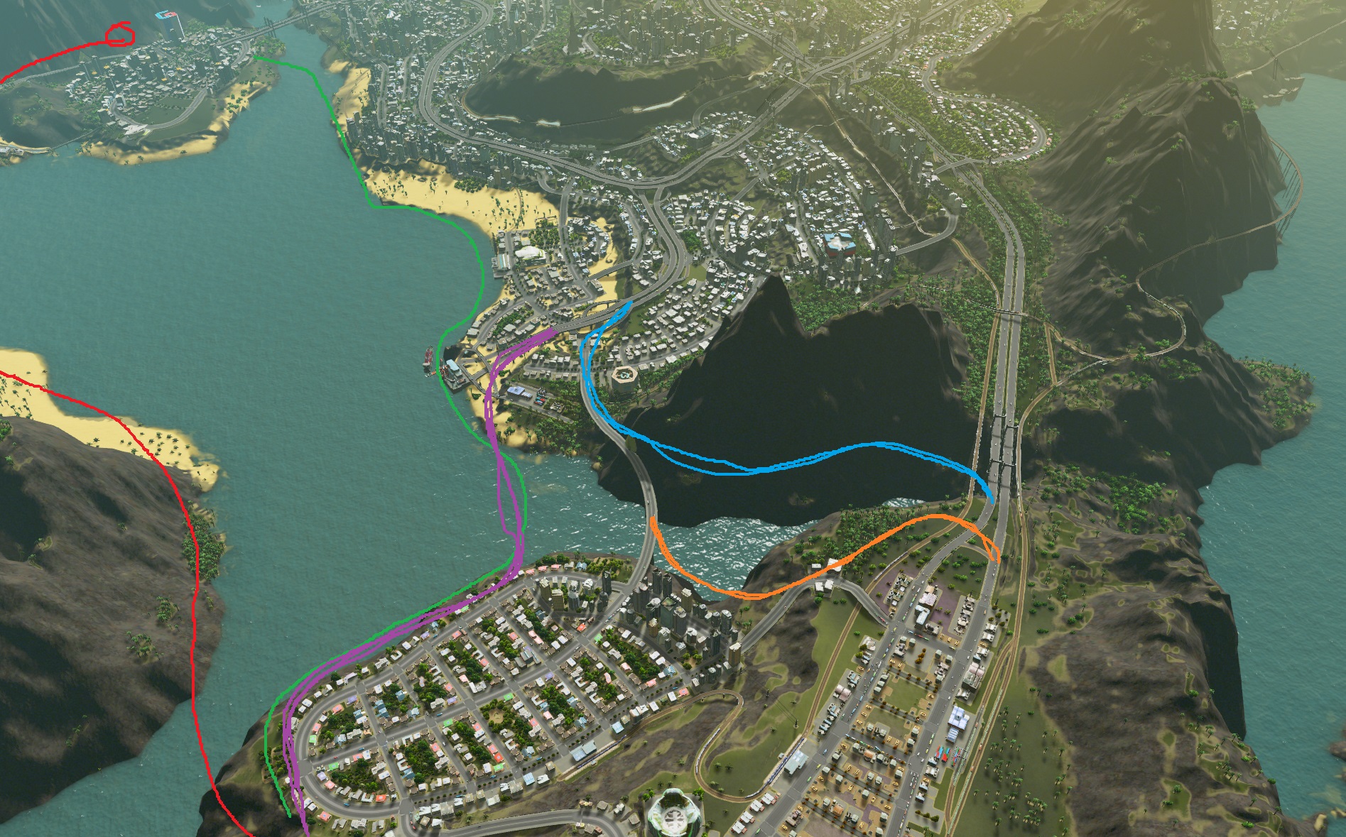
Here’s the outline of the regional network of my city (I couldn’t get a good camera angle with the overlays, so MSPaint lines will have to do). The color code is the same as the default one in-game:
Green = subways
Red = trains
Blue = buses acting as regional lines (I’ll explain this one later)
Orange circle are transfer stations; trip generators and the industrial zones are marked (universities are directly on transfer stations, since both are helped by being right in the middle of things). Unmarked areas are mostly combined commercial/residential/office.
The goal of this network is twofold: to be within (at most) a few minutes bus ride from every home or place of work in the city, and to offer the straightest path possible.
Case in point: As you can see, the subway mostly follows the highway. The logic behind it is simple:
– Highways were placed to make vehicular traffic as convenient as possible.
– To be competitive, mass transit has to be at least as convenient to get to the same places.
The train line was built to service the large industrial district (under the arrow) as well as the adjacent residential area. In the real world, this makes perfect sense, since trains are far cheaper to build and operate than subways, and are therefore a far more cost-effective way to reach your network out to/through a less densely populated area. Sadly, I’ve just realized that the same does not hold up in Cities: Skylines, where their advantages relative to subways are:
– Slightly cheaper to place (but more expensive to operate… what. It’s literally the same tracks, just sans the tunnels)
– Better able to cross terrain, thanks to bridges
– Slightly higher capacity
– More fun to watch
A subway may have been better. Regardless, the train connects to 3 of the 4 subway lines in the core of the city (so as to minimize the number of transfers required) then goes straight to the industrial district. 45% trip reduction, trains usually operating at capacity… seems to work OK.
TO REITERATE: Subways and trains should make up the backbone of the public transit of a decently large city. Their goal is to be FAST, and therefore both trace relatively straight lines, and have stops as far apart as reasonable bus routes allow. Speaking of which…
Buses: picking up the passengers
This was the first area of the city, and so originally operated on buses only, which sprouted radially from the downtown you see here.
Bus routes were dictated largely by topography. When I wanted to reach far, I stuck to a straight line (light blue). Closer in, the short distances let me stick to a small loop so as to maximize coverage.
This is also where I started the subway, which I plopped at what was already my “central station”.
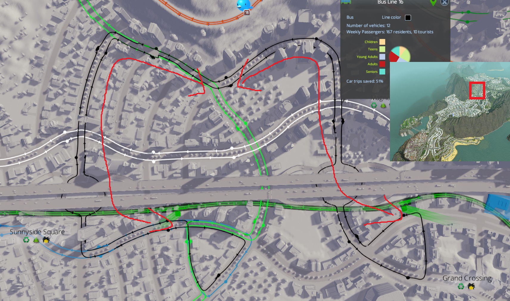
This black line is something I ended up doing a lot of, mostly because the mountains on either side kept the city from stretching too far from the backbone.
Functionally, it acts as two lines (indicated by the red arrows): on either side, if you want to get to the subway you can just pick the appropriate direction for the shortest route. In addition, since it runs part of the way parallel to the subway, it allows some interconnectivity that you wouldn’t get directly applying the idealized diagram above.
The green line is the same basic idea (granted it’s mostly offscreen). South, it acts as the main access to a large, low density residential neighborhood. To the north, it provides the same “act as two lines” role as the black line, albeit connecting to a different subway line.
Looking at this now, I realize that I haven’t adapted the bus lines since the last time I expanded this area. The red and black lines (which perform opposite-direction loops) should probably go around the entire district, with the white line cutting it in the middle. The idea:
– The red+black lines connect everyone along the outside to either the white bus line or the train station.
– Since they would be a bit far from the middle, the white line covers it. Its main goal is however providing direct access to the larger area in the background and the subway station there – local coverage is just a side benefit.
– The train line, as shown earlier, has its next stop waaaay across the city. Since I can’t conceive of a reason why someone would take the white line out here just to go twice as far in the opposite direction, I don’t directly connect white to the train station.
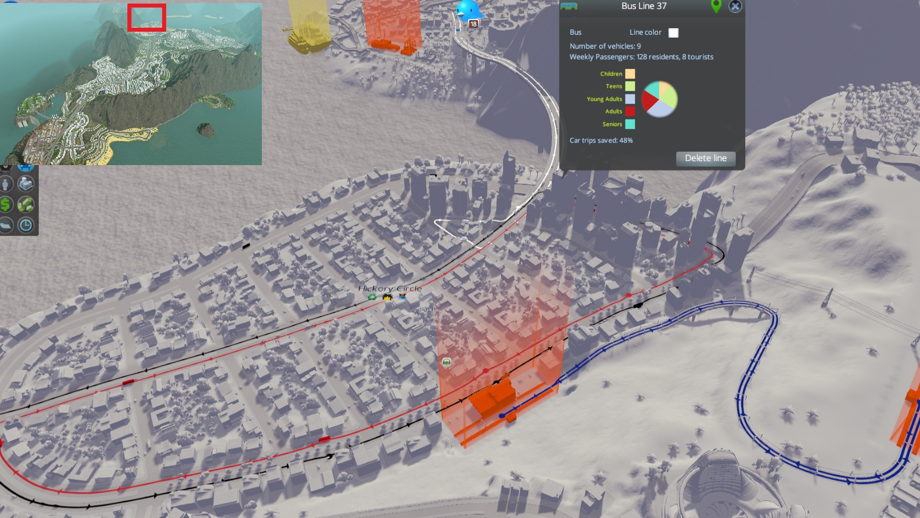
Finally, here’s the largest and densest area of my city. All the lines here follow the same basic logic as those presented above, with variations depending on the local road geometry and how I was feeling at that moment.
There are two things worth special note however:
– The red subway line is the one subway not to follow a highway. I placed it largely by feel to be honest, based on the long stretch of high density to either side with all in/egress limited to relatively narrow bottlenecks to the picture’s North/South. While I could possibly have replaced it with a bus line, the added capacity of a subway afforded me convenient places to anchor other buses, again cutting their effective max distance from a subway in 2 or more.
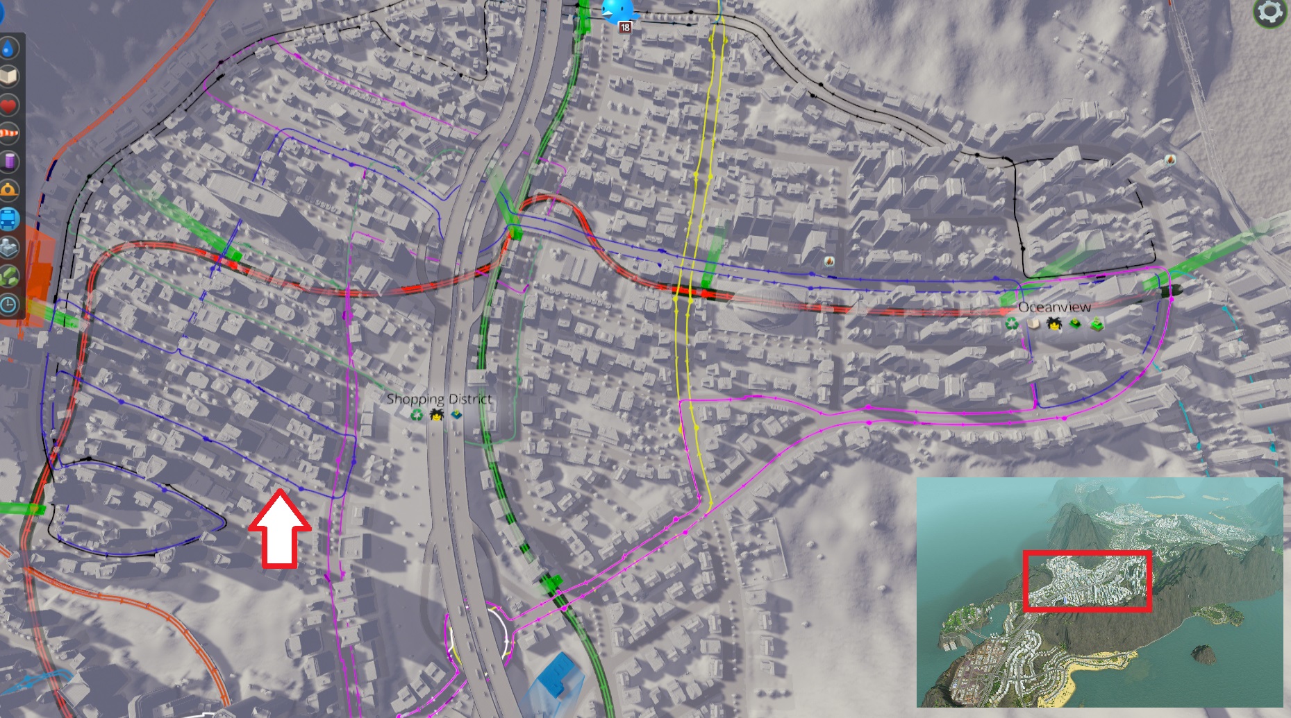
– The blue line (pointed to by the arrow) does some weird stuff and looks like it doesn’t follow any previous pattern, but it does: the large number of subway stations let me twist about to gain some coverage. It acts as “multiple lines”, except some of them are loops. (If this strikes you as confusing, that’s because it is. It took me a few minutes to confirm that the line wasn’t completely ridiculous. Point is, you don’t have to rigidly adhere to too many rules to have effective buses).
One question you may be asking yourself is whether it wouldn’t be better to just have multiple lines, instead of lines pretending to be 5. The answer is: I’m asking myself the same question. Both have upsides:
– Multiple lines allow shorter routes, decreasing the chance of a 1 hour wait followed by 6 simultaneous buses.
– Single lines minimize transfers, facilitating semi-local (read: not requiring the subway) trips.
I lean towards the former because it worked in Cities in Motion 2, but I need to do more testing to be sure.
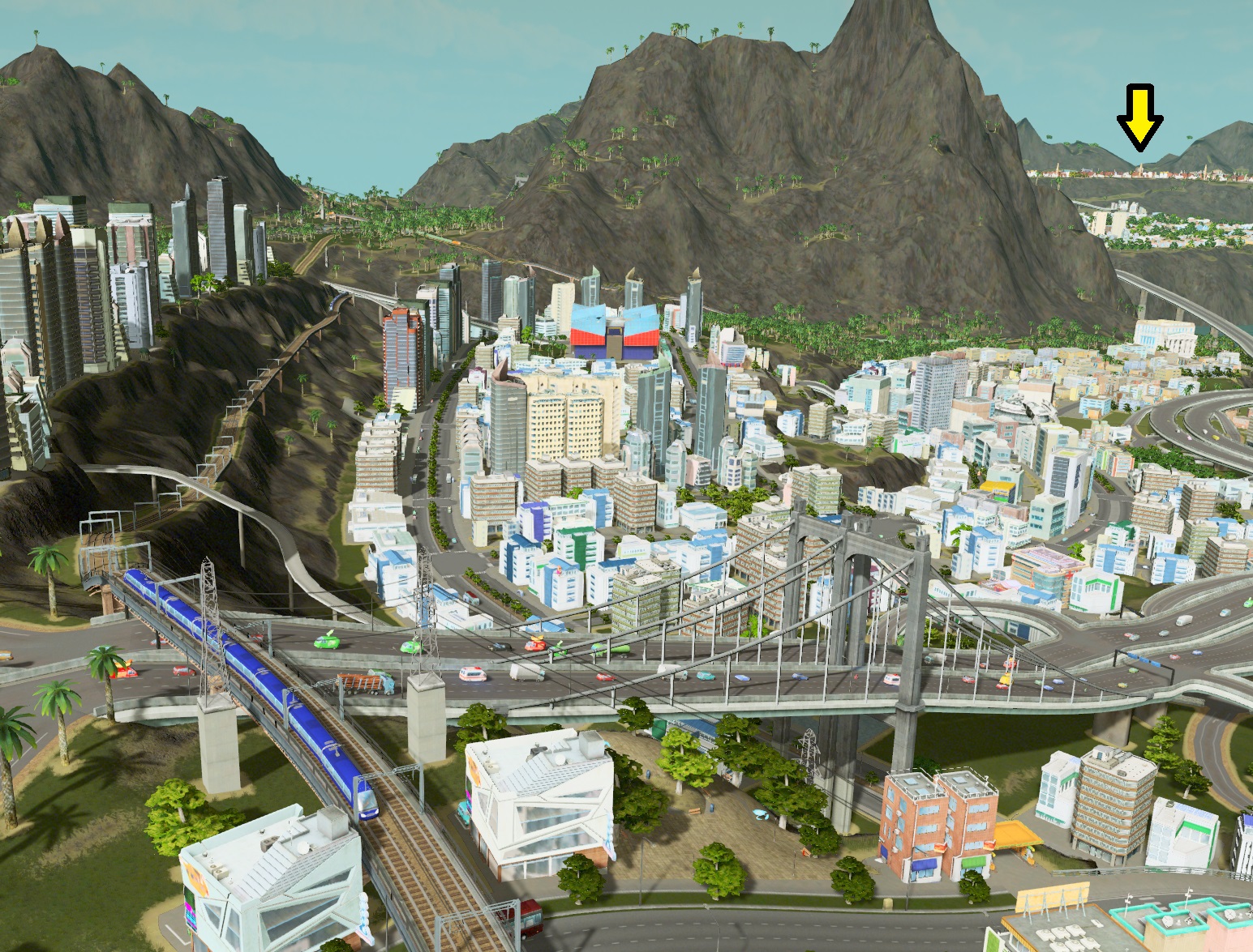
Special case #1: Long, linear path between subway stations

I can’t imagine this happening on most maps, but it did on mine. I had a long stretch of offices going between the airport/space elevator and the main area of my city. Not enough demand for a subway station, but that wouldn’t stop me from forcing some mass transit down their throats.
Doesn’t get much simpler than this: linear bus route between the two subsequent subway station. Bam: super (borderline unrealistically) effective.
Special case #2: Bus terminals
When I posted the first version of this guide, velcrox posted this impressive bus terminal. My first thought was “Wow, why didn’t I think of that that’s amazing.” The second was “I can’t imagine a situation where this isn’t complete overkill”.
Second view to highlight how it works.
The idea is simple: you have one or more primary line (typically long-distance and high capacity, i.e. trains or subways) bringing users to the terminal. They get off the train, take pedestrian paths (or crosswalks) to the bus stop leading where they want, and voilà. Where my typical bus lines just stop in front of subway station – which would cause serious traffic if more than 3 or 4 lines converged in the same area – this design allows for a whopping 20 buses (assuming 2 lines per stop, which in my experience is the limit).
If you want to have a more realistic bus network, or if you prefer shorter, more direct lines to my long ones, this is an excellent idea.
Of course, you can always use a scaled-down version.
This is the result of my expanding over a river, only to realize it was too deep to also extend the subway. Since this was the end of the map (and thus also the last planned stretch of subway tunnel) I replaced said last leg with an express bus directly from the station to here, arriving over the bridge just barely visible to the north. Effectively, I’m using a bus as a regional route, instead of a connecting one.
From there, cims can either take one of the 5 other buses covering the local area, or walk over the pedestrian paths if their destination is nearby.
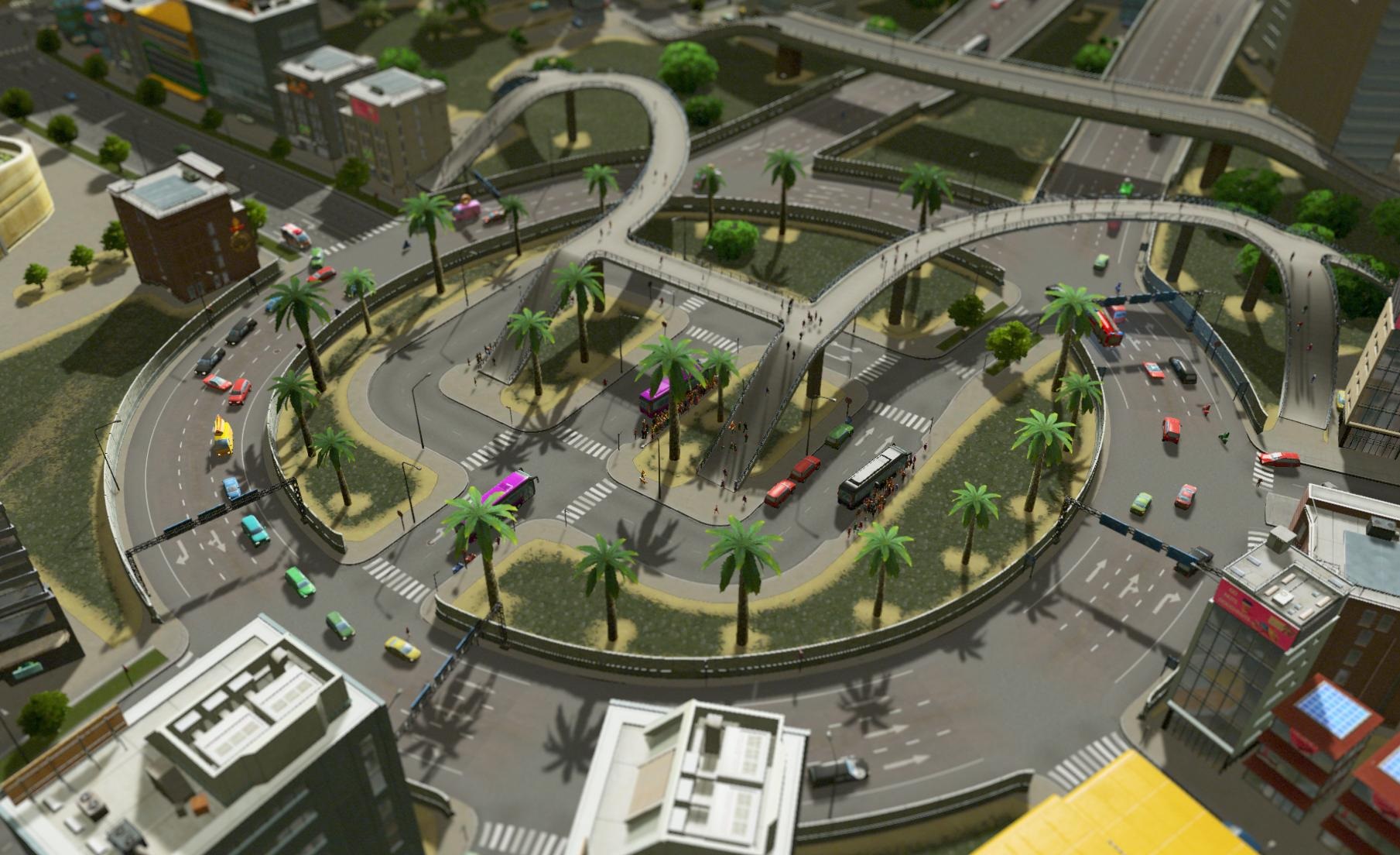
Note that placing a bus terminal inside a roundabout is a profoundly stupid idea. IRL, this would cause accidents pretty much every day. In game, it made managing traffic a pain. But I think it’s pretty, and now you’ve looked at it. So there.
PEDESTRIAN PATHS: The oft-forgotten public transit option
If you remember when I described the hierarchy of public transit options, I said that their equivalent of local roads was cims’ own two legs. Colossal Order included pedestrian paths for two reasons: they look good, and they’re extremely useful. (And not just in bus terminals).
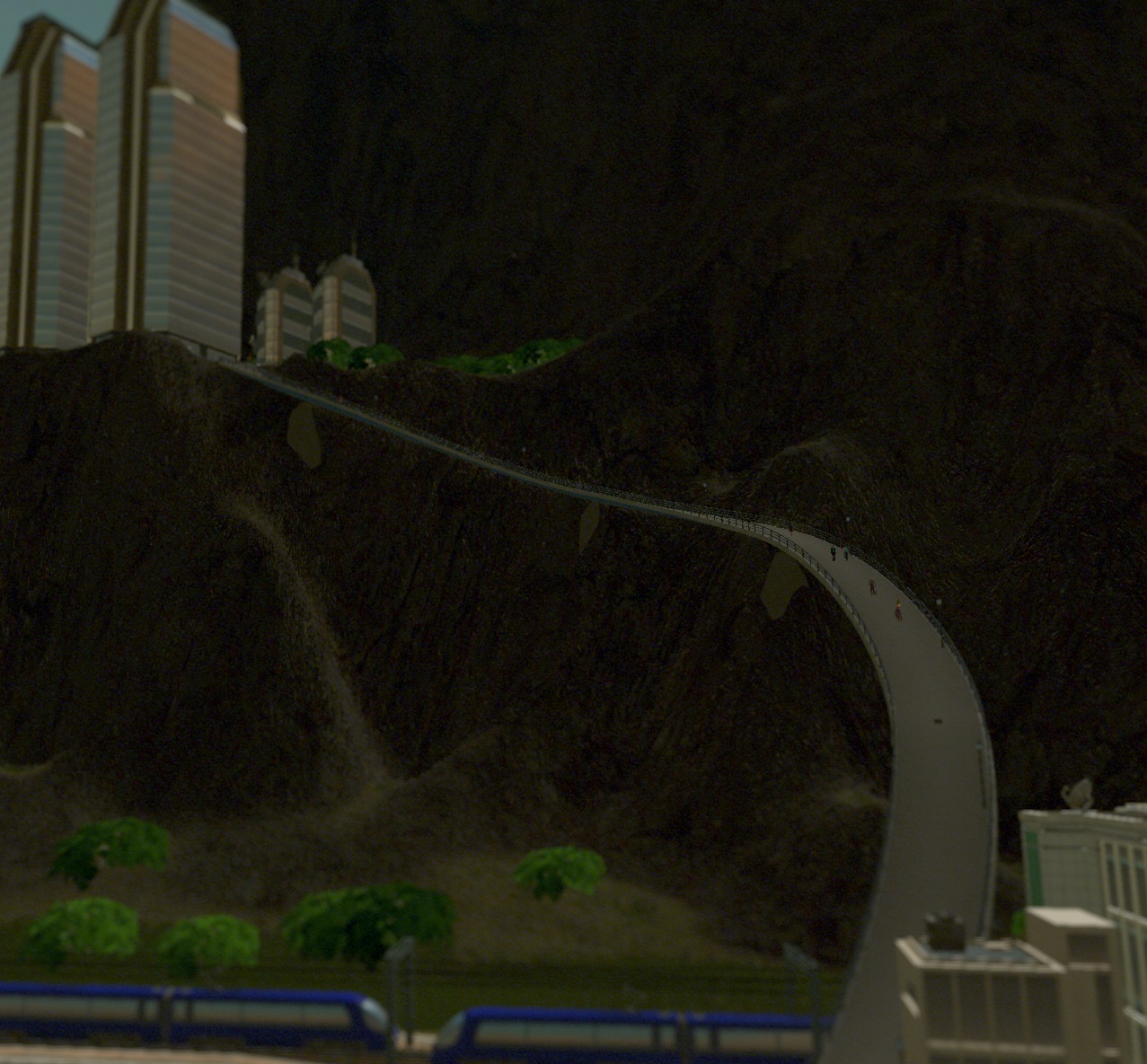
This is the same area as above with a larger, birds-eye view. As you can see, the area above downtown is connected only by the road of the far left. The slope is too steep for the road to come back down (at least, not without some serious zig-zagging) and walking all the way around is too far for cims to seriously consider. A bus line could connect the hill to the train and subway stations on the bottom, but that’s a waste given that they *are* technically in walking distance.
Fortunately, pedestrian paths are smaller, can make sharper turns and can be steeper (think stairs, though you don’t see them) than even the smallest roads. Added benefit: cims have no qualms with making 100m vertical climbs in their daily commute. Effectively, these paths extend the range of the stations below at almost no cost.
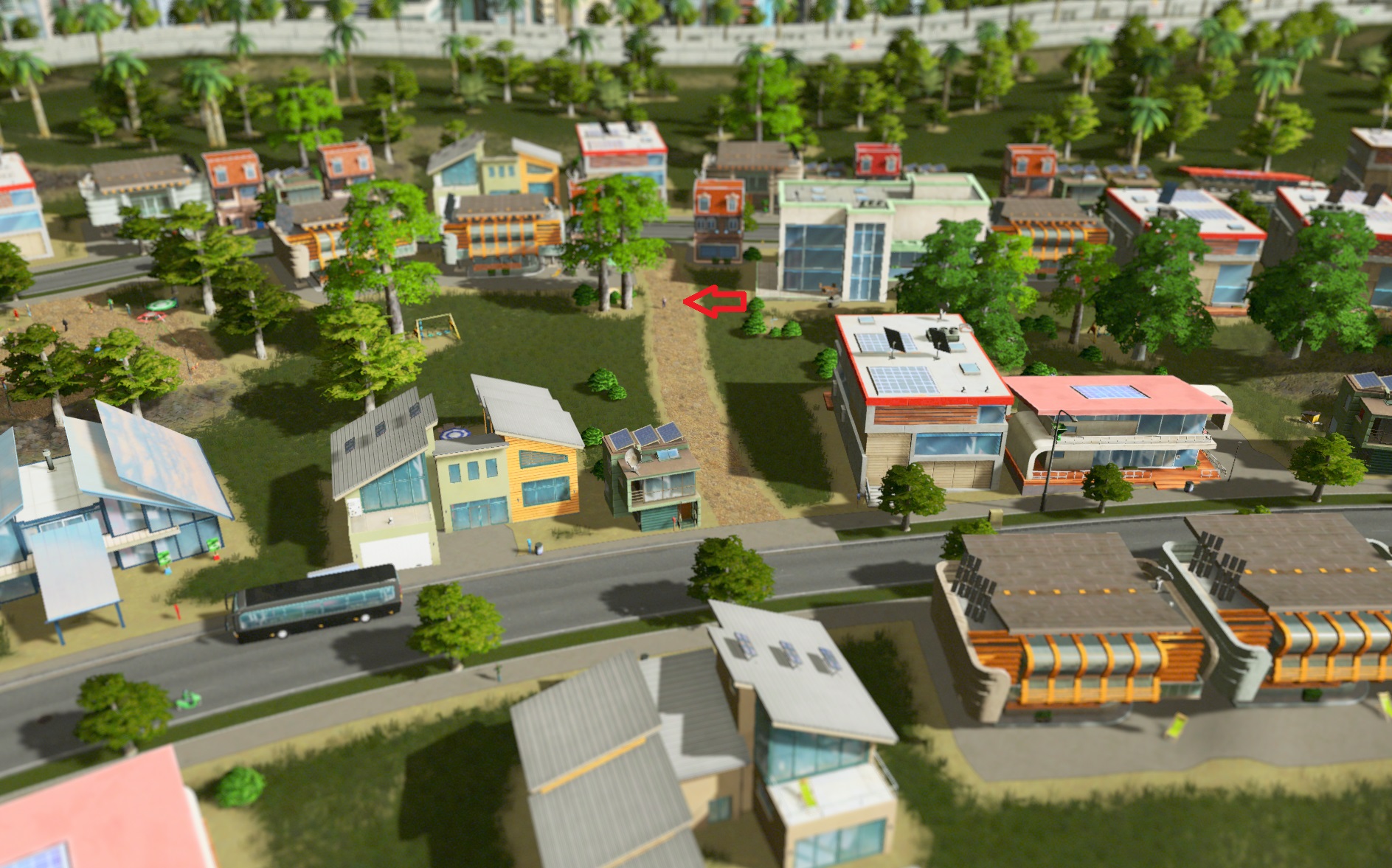
Of course, their use isn’t limited to steep hills. In this low-density district, blocks are long, which would normally be inconvenient for reaching the one street with a bus line. While I could have cut the blocks with roads just to let pedestrians through, it was again cheaper and prettier to give them their own paths.
Their small width also allow you to minimize damage while you trace them through neighborhoods. You can often squeeze them between existing buildings (unless you on a grid, where those gaps don’t exist).
Unfortunately, path or no, that old man seems to have missed his bus :(
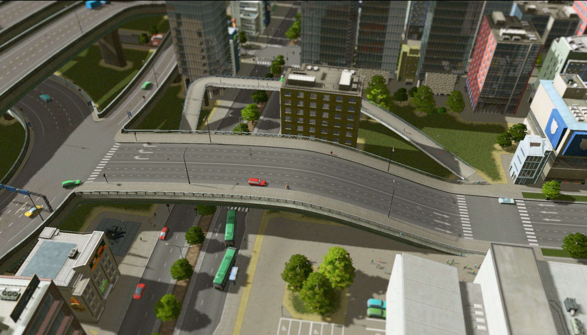
Of course, pedestrian paths don’t have to be limited to the outskirts. Here, while messing with road geometry to solve some traffic coming off the highway (in case your curious, the stretch of road between the roundabout and the 4-lane avenue was too short, causing backup and leading me to raise the whole thing into the air) I inadvertently ended up cutting off the main access from the subway station on the left to the university in the lower right.
You’d think they could use that crosswalk right there and then WALK ACROSS THE OPEN ASPHALT, but no.
Fortunately, a path over the avenue and curving behind that building gets them right to class.
PROBLEM SOLVING
The above having taken me something like 12 hours, I don’t have much energy left for the problem-solving portion of this guide. But I also don’t feel like hanging you guys out to dry, so I’ll skip all the relatively simple ones and get straight to a problem that took me over 2 hours to solve.
I warn you in advance: the solution is a little anti-climactic. The steps in between, however, consist of most of my bag of tricks, so hopefully you’ll get something useful out of it.
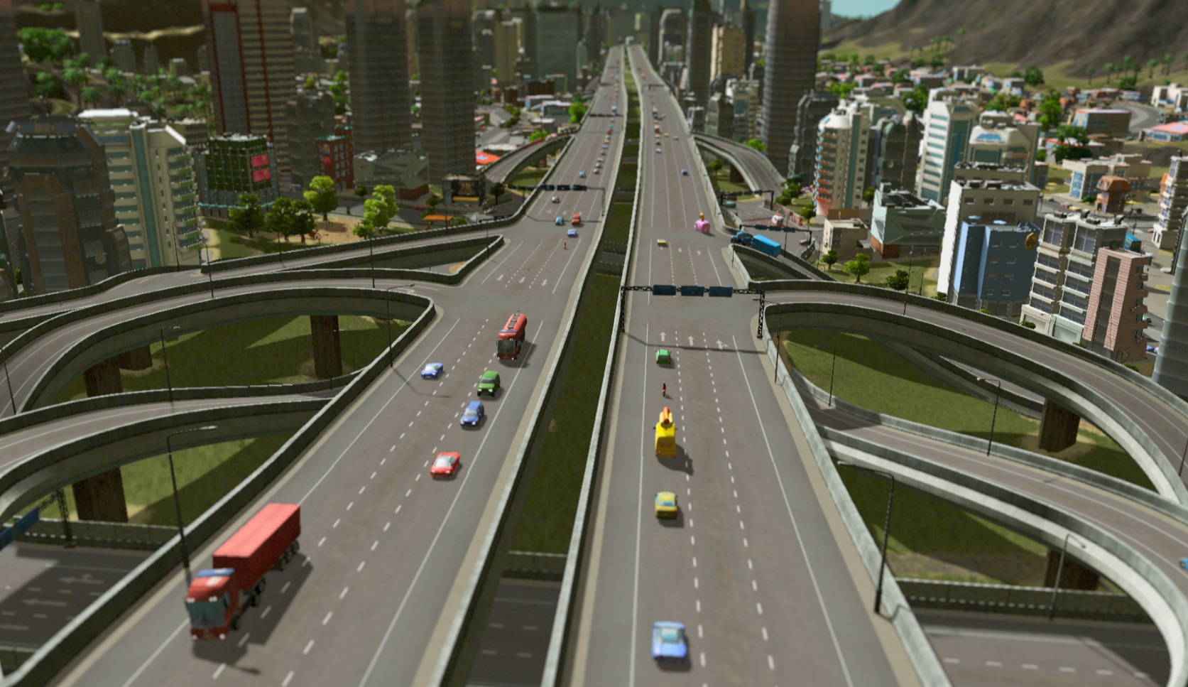
So there I was, expanding my city to some new land. Take a short break to admire what I’ve done so far, and…
Uh oh. Something like 6km of traffic. That’s definitely not good.
STEP 1: Localise the problem
Easy enough: it’s the place where the traffic starts (or ends, I guess, from the perspective of the drivers). It also happen to be on my favorite interchange. :(
STEP 2: Identify the problem behavior

That doesn’t look like a legal merge to me, Mr. Truck.
Essentially, trucks are slowing to a standstill, turning almost 90 degrees, and then inching their way into a forced 2-lane change. Appalled by this reckless behavior, drivers upstream are stopping.
-> traffic
STEP 3: Has something changed that might cause this?
Fortunately, that’s obvious in this case. It’s probably that area I was building attracting extra traffic.
STEP 4: Confirm suspicions.
SimCity 4 veterans might bemoan the absence of the road-query tool, which allowed you to know the origins and destinations of all the users of a given road with a single click. Instead, we have the more laborious task of polling people individually.
Aside: I once had the task of stopping road traffic and asking them this exact information IRL. For 16 hours. In Nowheresville, northern Canada. It sucked.
Suspicions confirmed

While traffic already on the highway is pretty much business as usual, the line of merging trucks is all coming from the industrial district pictured and heading to the newly-constructed commercial area. Ok.
STEP 5 (Optional): It wasn’t like this before, right?
Fortunately – thanks to kindly redditors asking for my save – I had a prior version of the city on the workshop. Looking at the same area, things were ok… but barely. This kind of merger was happening, just not regularly enough to cause more than a few second of slowdown on occasion.
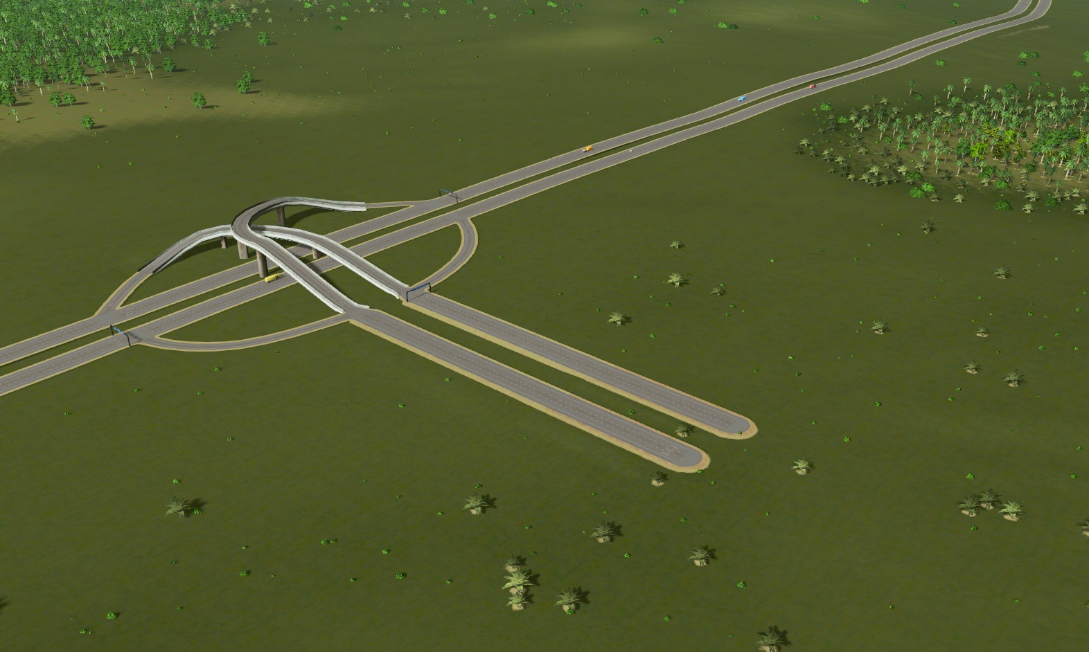
STEP 6: Can I just fix the interchange?

Short answer: no. There is no way a larger onramp would fit – and even if it did, it wouldn’t avoid them merging. Same deal with placing it on the other side. Besides: I love this interchange, it’s so symmetrical.
STEP 7: Add capacity somewhere else?

There WAS another route that leads from industry to new commerce… or is there? I built the circled interchange a long time ago – before my city reached anywhere near here – in order to connect to the harbor. There was no point then of allowing a left turn from industryville, and I never thought to add one since.
STEP 8: Manually reticulate some splines

Road construction is so fiddly sometimes.
STEP 8.5: WAIT
Don’t forget that your city needs some time to readjust, as vehicles either chose a new path or simply new vehicles spawn with knowledge of the new road layout. Then they have to actually get to the affected area. Meanwhile, the problem areas need some time to clear out, even if everything is technically A-OK.
STEP 9: Did it work?
Well, most of the vehicles using the new ramps are definitely moving to and from the right places, but…
No.
It’s slightly better. More vehicles are going through… but not enough to fix the problem permanently. Ugh.
Same deal, those ridiculous merges.
STEP 4, again
Polling the trucks tells a simple story. The new route is the new route of choice for SOME of the trucks, on the far end of the industrial district. The others still prefer the original route, lacking access to Google Traffic.
STEPS 10+: What else can I do?
Lots of other ideas to increase capacity. Make the connection a direct highway (blue)? Won’t fit.
Add a speedy onramp (orange) or alternate highway (purple)? Fits, but then the weird-merger problem just happens in the new interchange. Right.
Direct, coast highway? Would work, but impossible to make not hideously ugly.
Train over the other islands, bringing goods to the commerces’ doorstep? Nowhere to fit it at the destination, islands would look like a jumbled mess.
But wait… what about some econ 101? Instead of increasing capacity, decrease demand?

This new area could probably survive with, say, 8 less stores.
They’d probably prefer being somewhere more central, anyway. The offices they’re replacing can go back there near Colossal Order, for inspiration.
Again, we wait for the situation to reach the new equilibrium…
Bingo.
Well, that was easy.
Moral: sometimes all the traffic engineering in the world can’t beat a slight adjustment to your urban planning.
(told you it was anti-climactic)
Time to end with some…
STARTING OUT – BUILDING TO 10 000 CIMS
Probably the question most people have asked me is what to do in the early game. I’ll remind you right away that I’m a traffic engineer; while I’d like to think I’m very good at management games overall, I’m by no means a certified expert on things that aren’t immediately traffic related, so take everything that isn’t road design with a grain of salt.
Anyway, you hit New Game and you’re staring at this. You have three immediate problems:
– You have very little space with which to spread things out.
– You have relatively little money with which to build infrastructure.
– Most of said infrastructure isn’t unlocked in the first place.
Essentially, most of this guide doesn’t really apply to you yet… But if you completely forget about it, you can easily paint yourself into a corner. Step one is to figure out the most basic part of your plan: which way are you going to expand?
Option 1: You want to extend away from the existing highway
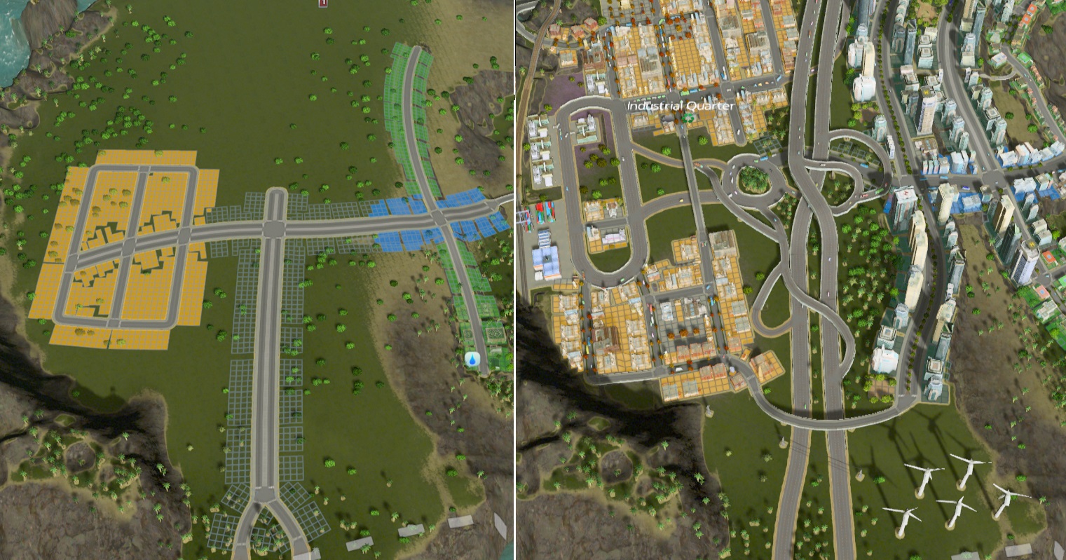
You might want to do this for a number of reasons. You may want to have your city extend towards the coast. Alternatively, you may be playing on Raerei Cove like me, and not have any other choice.
Above is the (recreated) before-after of my city. Here’s the thought process:
– I’m going to want a highway up the middle, even though I can’t build one now. I’d better leave some room for it.
– For now I’ll use an avenue, connected to the highway with 2 1-way-2-lanes.
– Off this road, I’ll need connector roads for sure. May as well build them now.
An important thing to note with any start is that it’s very unlikely you’ll get it perfectly right right at the start. You can see the highway junction I ended up with is an absolute (but functional) mess, and that what used to be a grid of pure industrial on the left has become an elongated roundabout serving a bunch of incinerators and a cargo train station. Real cities change, and yours probably should too.
Option 2: You want to extend alongside the starting highway.
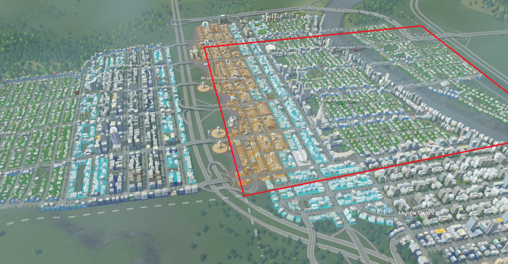
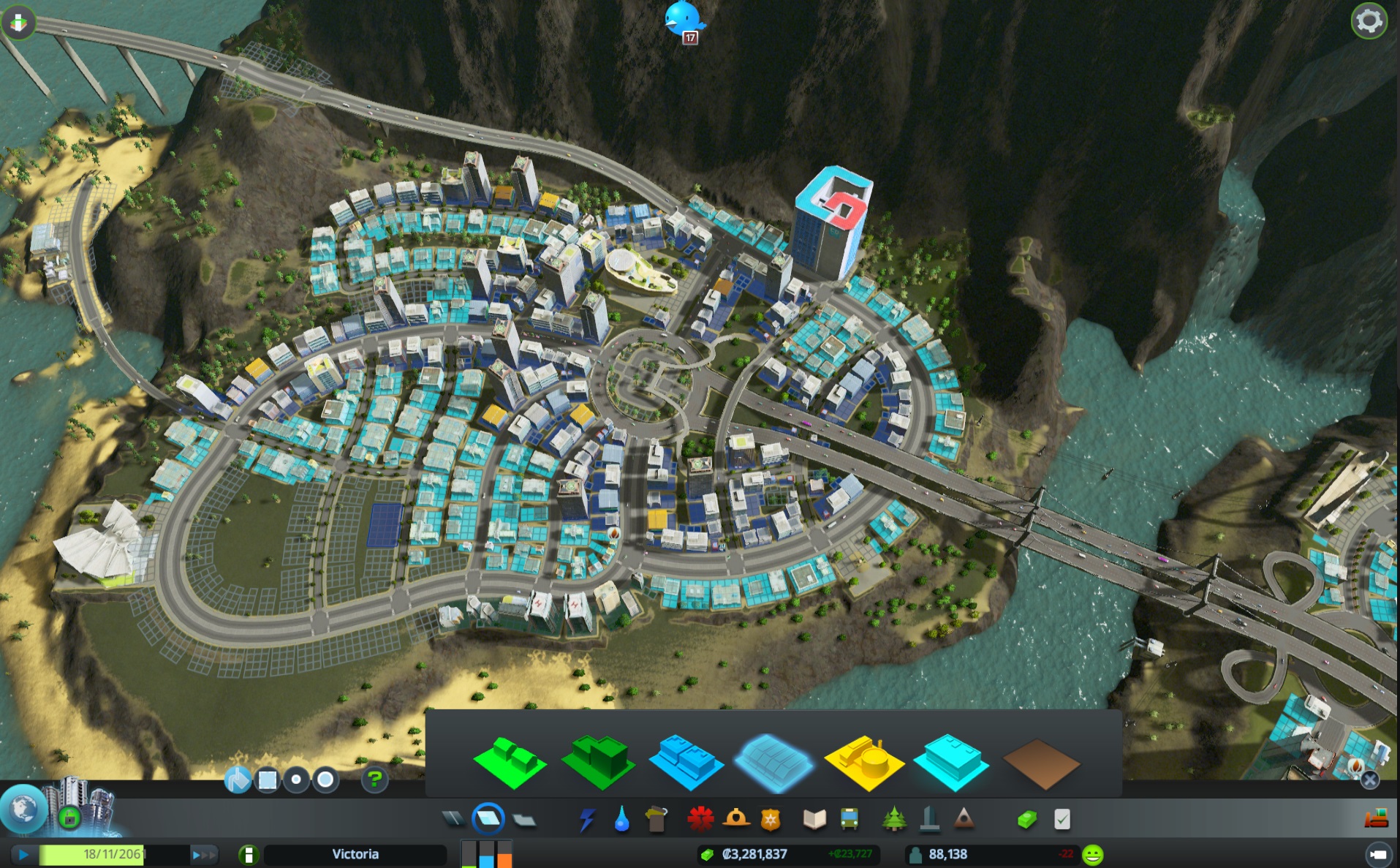
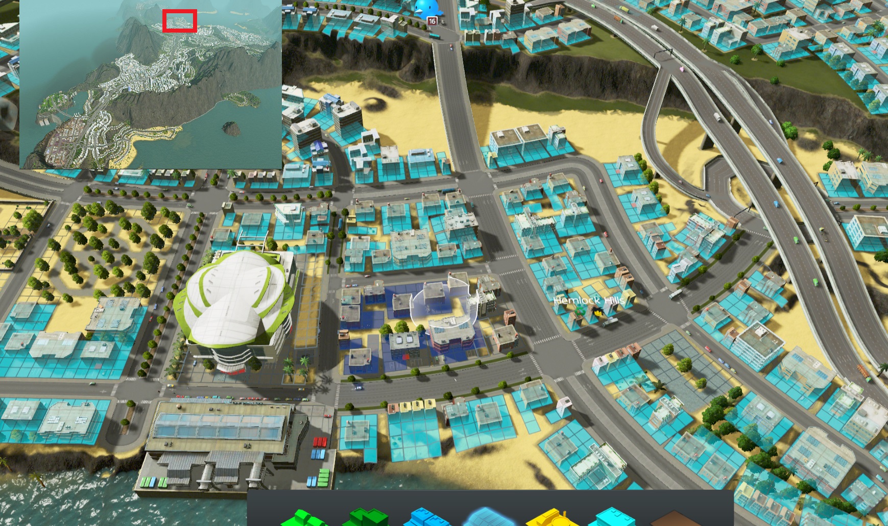
In some ways, this case is simpler. The city above is my second one, a more typical grid with the starting zone shown by the red box. It has a population of 62 000, just about to hit peak-traffic.
The initial connection was the same, but industry was concentrated near the highway for easier access (they’re the ones who will use it most, and the least likely to mind the noise). This kind of city is arguably easier to plan out, since you can just repeat the same pattern again and again. There’s also the advantage that only on a few stretches of road do cargo and personal vehicles intersect (particularly after I build a massive commercial district across the highway).
However, you need a higher density of connecting roads parallel to the highway (as you can see going through the office/commercial) since very few internal trips will path on the highway itself.
Said connecting roads are more concentrated around the high density zones on the right, since those generate more trips. Looking at these for the first time in a while, I realize they seem to contradict what I’ve been saying thus far. I’ll go over them in a tip later.
Note that where the line of offices is now used to be empty space, left to isolate people from the industries. I filled it in later as the industry leveled up.
Sorry if this section is short – to be honest I never put any thought into how I do this. It’s mostly trained reflex from decades of city builders, but hopefully you can gleam something from the basic layout and idea.
MISCELLANEOUS TIP #1
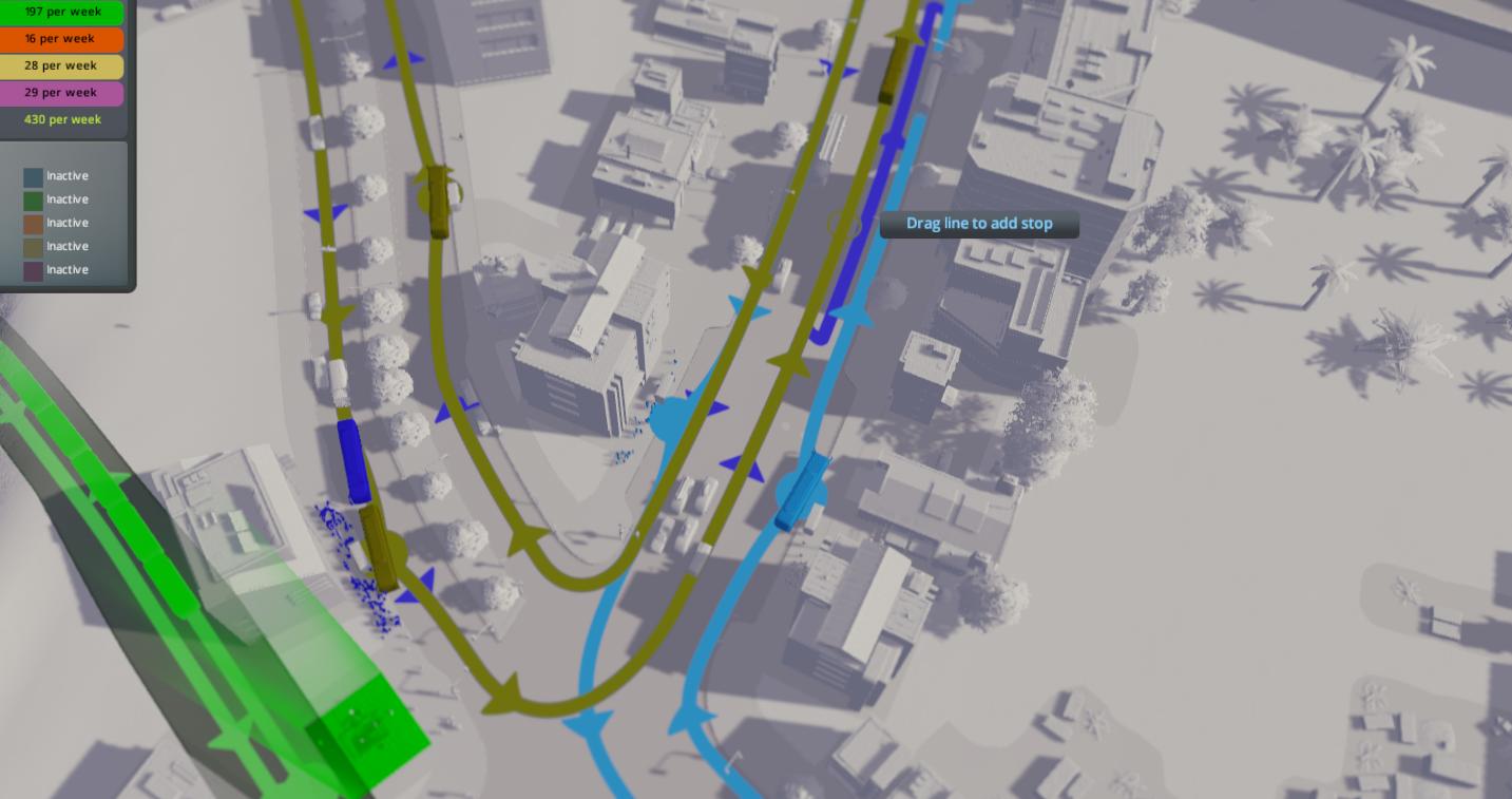
Ironically, buses can be a major source of congestion. Despite apparently emptying and filling up almost instantly, they wait a set amount of time at the stops, making buses behind them block up a lane while they wait. If you have a lot of lines converging in one place (say, at a subway station) try having a few adjacent bus stops for the different lines. One stop for every two lines seems to work for me.
MISCELLANEOUS TIP #2
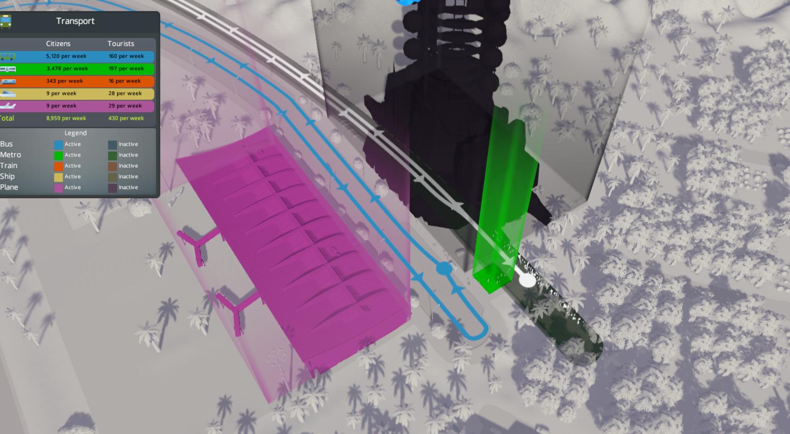
Just as a regional road doesn’t HAVE to be a highway, long distance public transit doesn’t have to be trains or subways. I built the latter here after plopping the space elevator, but when it was just an airport I connected it to downtown (specifically, the central subway station) via a bus line with just the two stops. Each plane-load can generate up to 100 cars, and this brought that down to almost zero.
MISCELLANEOUS TIP #3
The game warns you about this in extreme cases, but don’t have intersections too close together! This avenue acts as a service road for the highway, but bends away from at the exists so as to avoid backing up traffic into the roundabout. Speaking of which…
MISCELLANEOUS TIP #4
Traffic lights only matter when they’re red!
This section of my second city is probably the densest grid possible, and is full high-density development. In many cities, this would be a serious problem, but here it works perfectly fine. Why?
Simple: all the roads leading to the places people might actually want to go are huge. They could conceivable get somewhere by going north long enough, but they would end up going through blocks and block of suburbs, and no one wants that when they’re a big fat avenue just sitting nearby. The only people who would want to use them would be those pulling up to their homes – at most 2 per block.
The end result is that there is almost no demand for a green light in the vertical axis, and therefore the 6-lanes are free to give green lights almost all the time.
Of course, the zoning in your city has to be just-so for this to work… but it can.
“roundabouts are so great why aren’t you building them everywhere omg”
Roundabouts are indeed pretty sweet. To be honest, you can ignore almost everything you just read and plop roundabouts everywhere. As an added bonus, they look nice and are a central tool for ton of the amazing cities I see. The only downsides are that they take a little longer to build, and they take a lot more space.
Personally, I feel like relying too much on roundabouts is a lot like sticking to grid-based cities: it can definitely work, but it gets a bit repetitive to build. That said, I do use them where I need to (mostly to connect to highways) and occasionally make random ones since they’re undeniably pretty. Like everything else in this game, what you do is up to you.
MISCELLANEOUS TIP #5
Stay flexible and have fun.
Remember that this guide has been more about building solid cities than perfect ones. I would rather play around faults in the AI than abuse them, and I prefer having cities work despite their flaws than building ones that are flawless.
Consequently, I suggest seeing everything here as helpful suggestions, not strict guidelines. After all, if being a traffic engineer made me infallible, traffic wouldn’t exist.
:D
Thanks for reading! This took a lot longer to write than I’d planned, so I hope it helps someone out.
Have fun building!

Does the public transit make money Or at least break even? I tend to judge If Its efficient based on Whether Or not the line is Bleeding money in these types of games. And I haven’t found a solid answer to Whether Or not mass transit in this game can be looked at that way.
Thank you for this AMAZING guide ! You did put a lot of work in it and it’s crazy, thank you so much !
OMG Thank you a lot ! It is a lot of work that you did there and thank you for it its amazing !!
Thanks so much for the great guide!
You sir are a legend thanx for all the work
Thanks for your very useful guide.
Could you please upload your savegame at workbench and link it here so that one could check yor map detailed.